Forecasters have taken Louisiana completely out of the cones for both tropical systems threatening the Gulf of Mexico.
Tropical Storm Fred is forecast to hit the Florida Panhandle tomorrow.
"On the forecast track, the center of Fred should move across the eastern and northern Gulf of Mexico through Monday, then make landfall in the western Florida Panhandle Monday afternoon or Monday night," according to the National Hurricane Center.
The biggest impact will be rain.
"Heavy rainfall across portions of Florida, southern Alabama, portions of Georgia, and the western Carolinas could lead to flash, urban, small stream and isolated river flooding impacts."
Meanwhile Tropical Depression Grace is moving toward the Gulf of Mexico.
It is now forecast to stay south of Louisiana as it moves across the Gulf.
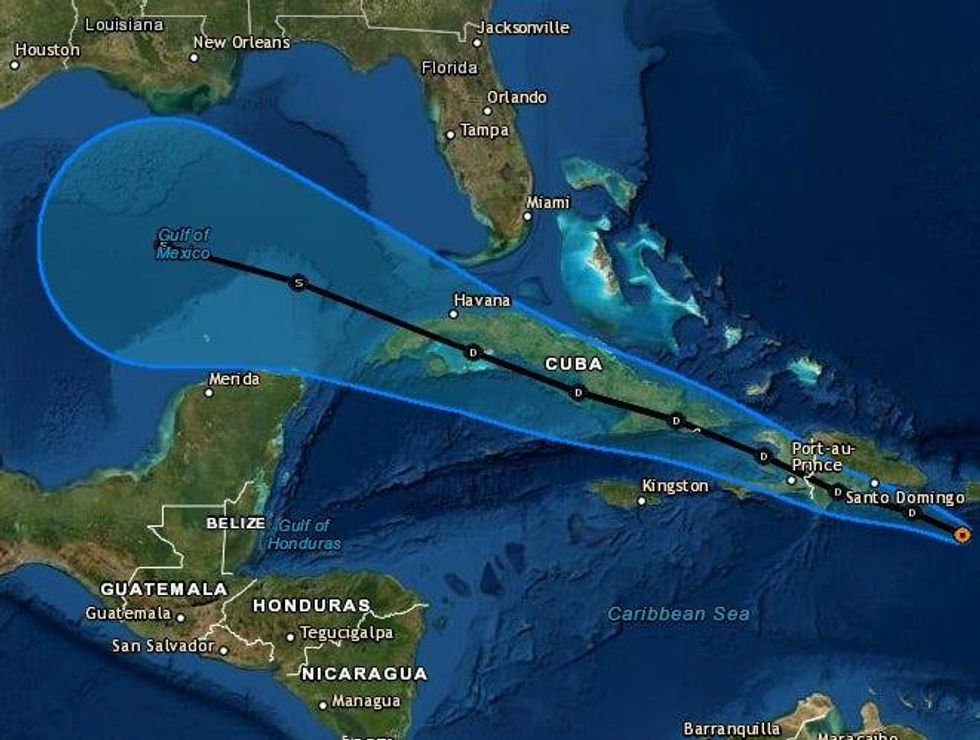
"The official track forecast has been shifted a little south of the previous one, following the multi-model consensus."
That, however, could change over the next five days. Grace still has to cross the Caribbean.
Forecasters say the uptick in tropical activity serves as a reminder that we are getting into the more active part of the season. The statistical peak is still nearly a month away.