Southeast Louisiana will feel a big chill this week.
"We get truly chilly fall weather," WWL TV Meteorologist Payton Malone forecasts. "The front will slide south by this evening. Tonight starts to turn chilly as temperatures fall into the 50s."
He says tomorrow high temperatures won't get out of the 60s.
"It turns even colder starting Tuesday night. Wednesday and Thursday morning temperatures will be in the middle to upper 30s north of the lake and 40s south of the lake... Frost will be possible north of the lake on Wednesday and Thursday morning."
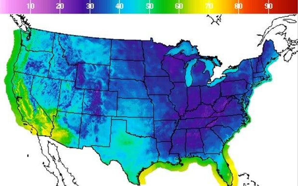 NWS
NWS
Malone forecasts highs thouse days will be in the 60s. The cold blast doesn't last.
"We start to warm up by Friday in the upper 70s with low 80s for the upcoming weekend."
Detailed Forecast...
TODAY:
20% spotty showers and storms early. Falling temps, becoming less humid. Breezy. Low: S 68, N 55. High: 82.
TUESDAY:
Chilly morning. Cool afternoon. Mostly sunny and breezy. Low: S 56, N 49. High: 69.
WEDNESDAY:
Chilly morning, cold Northshore, possible frost. Sunny and cool afternoon. Low: S 48, N 37. High: 64.
THURSDAY:
Chilly morning, cold Northshore, possible frost. Mostly sunny and pleasant. Low: S 48, N 39. High: 69.
FRIDAY:
Mostly sunny and a little warmer. Low: S 60, N 52. High: 76.
SATURDAY:
Mostly sunny and a little warmer, bit more humid. Low: S 65, N 51. High: 79.