


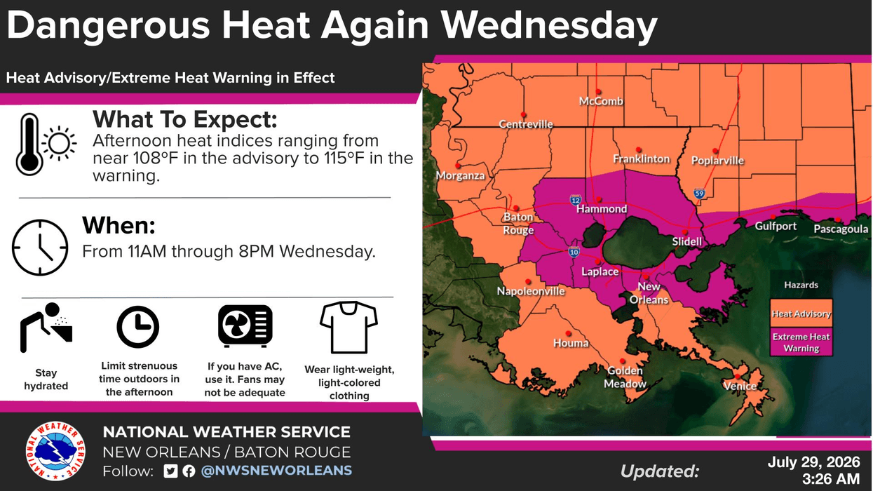

New Orleans and the surrounding areas are under another extreme heat warning as we will see our hottest temperatures yet this summer.
Heat indices will reach as high as 113° in New Orleans today. Take precautions if you’re working outside, including hydrating and getting inside a cool location as often as possible.
Actual air temperatures will top out around 96° today. The good news: temperatures will dip slightly over the next few days. However, high temperatures will remain in the low 90s through the weekend, with heat indices remaining well in the triple digits.
Rain chances enter the forecast today, with a 20-percent chance of showers in the forecast. Those probabilities increase to 40 percent and 50 percent for the next five days.
WEDNESDAY:
Partly cloudy. 20% isolated shower. Hot, humid. High: 96. Winds: W 5-10.
THURSDAY:
40-50% scattered showers. Still hot, humid. Low: S 80, N 78. High: 94.
FRIDAY:
40% scattered showers, storms. Hot, humid. Low: S 79, N 77. High: 93.
SATURDAY:
40-50% scattered showers, storms. Low: S 78, N 77. High: 92.
SUNDAY:
50% scattered showers, storms. Low: S 78, N 76. High: 91.
MONDAY:
50% scattered showers, storms. Low: S 77, N 75. High: 90.
TUESDAY:
Partly cloudy. 30% spotty showers, storms. Low: S 77, N 75. High: 92.


