NEW YORK (1010 WINS/WCBS 880) -- Stormy, humid weather continues to grip the Tri-State this week, with dangerous winds and drenching downpours forecast to threaten the area again on Tuesday.
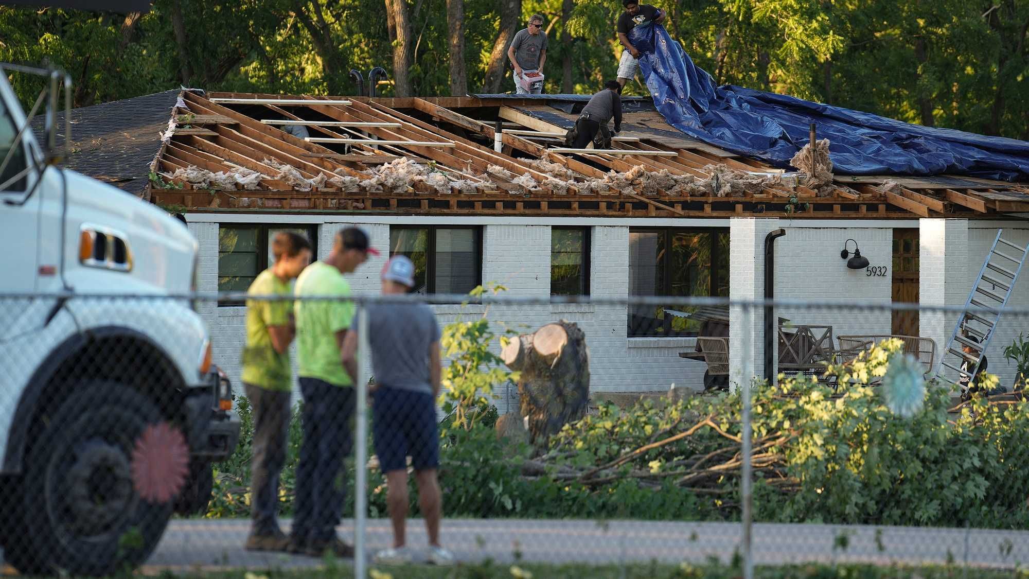
The week kicked off with severe thunderstorm warnings for parts of New York City and North Jersey. The National Weather Service warned that 60 mph wind gusts, quarter-size hail and soaking rain could pop up in spots.
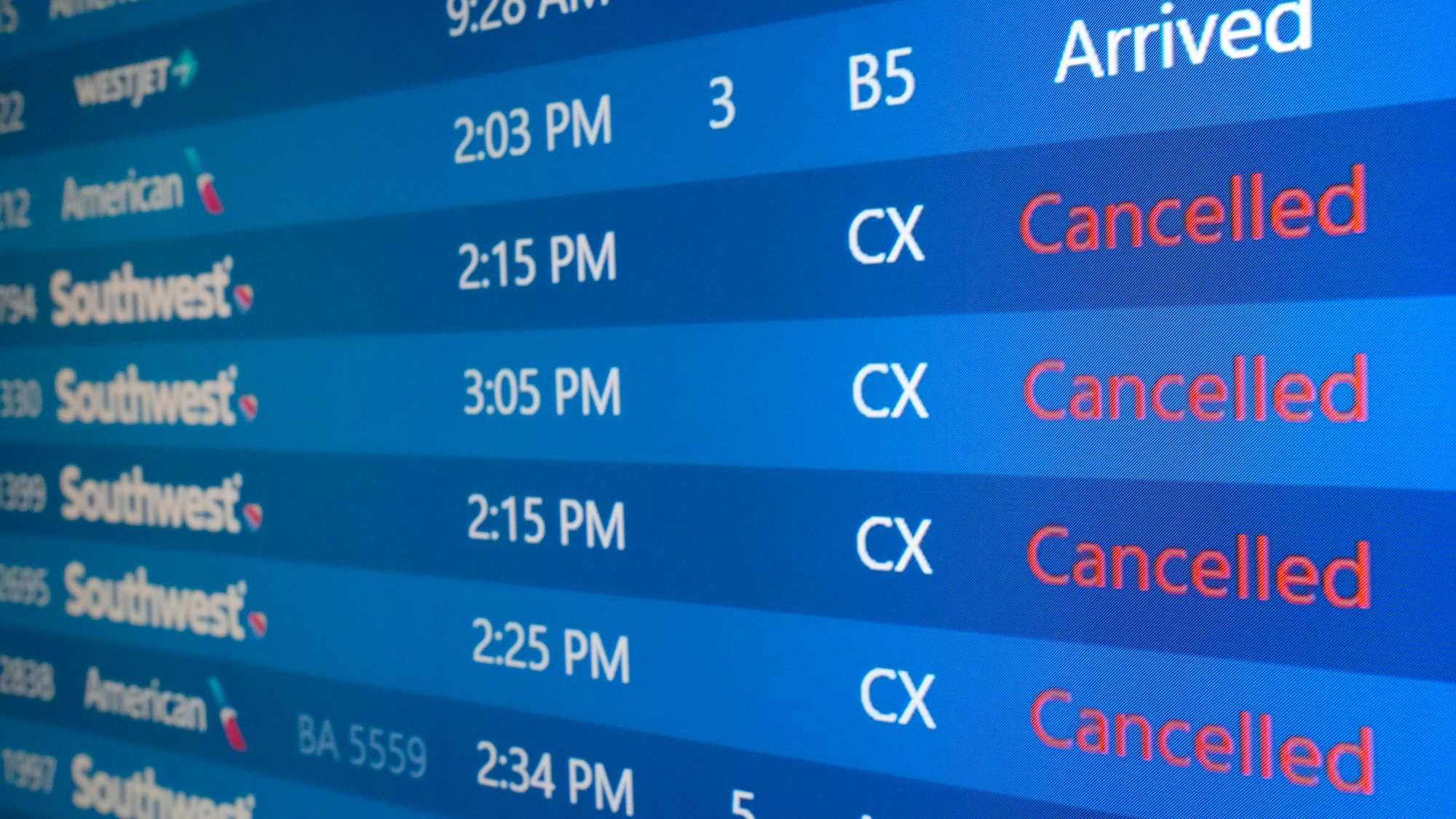
Storms caused well over 500 flight cancellations, and hundreds more delays, at LaGuardia, JFK and Newark airports on Monday.
The unsettled weather is forecast to continue throughout the day Monday, with the most severe weather expected in the afternoon and evening. A hazardous weather outlook has been issued for all of New York City, Nassau County, North Jersey, the Hudson Valley and southwestern Connecticut.
 AccuWeather
It's otherwise sticky and mostly cloudy Monday. The high will be about 80 degrees in the city, but the humidity will make it feel more like the 90s.
The muggy, cloudy weather is forecast to continue overnight as temps drop to the upper 60s.
 AccuWeather
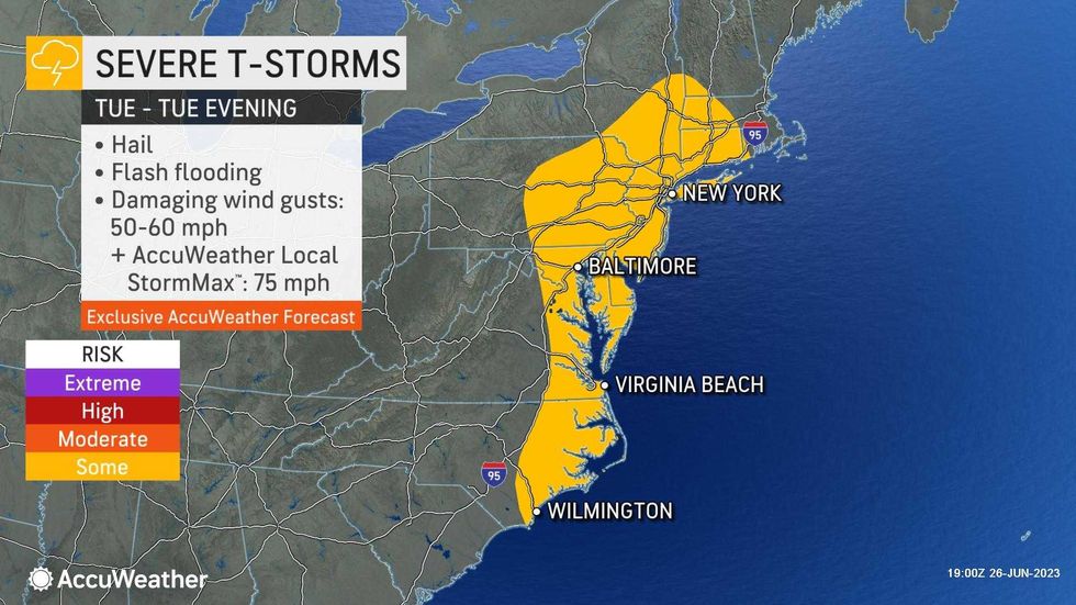
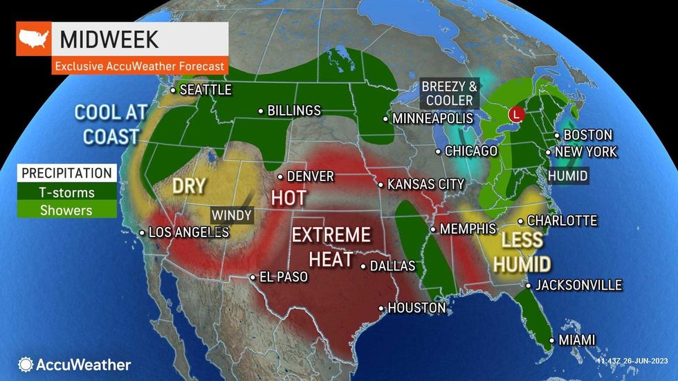
Tuesday and Wednesday will be like Monday, with high humidity and the potential for heavy rain and damaging storms. Highs will be in the upper 70s.
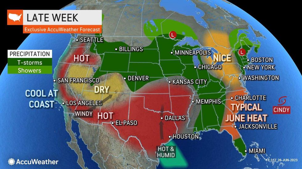
The storm threat and sticky conditions will linger Thursday and Friday. Prepare for showers and storms in the area on both days as highs top 80.
The potential for storms is forecast to continue throughout the weekend and into next week, including on the Fourth of July on Tuesday.
 AccuWeather