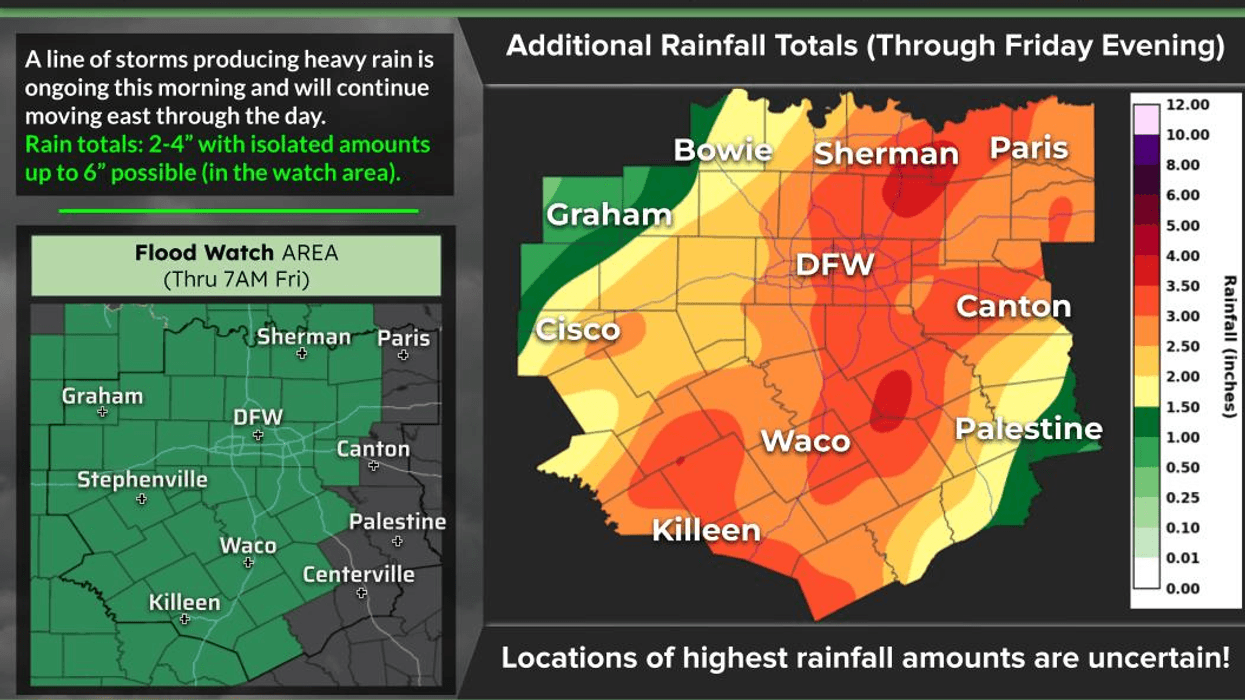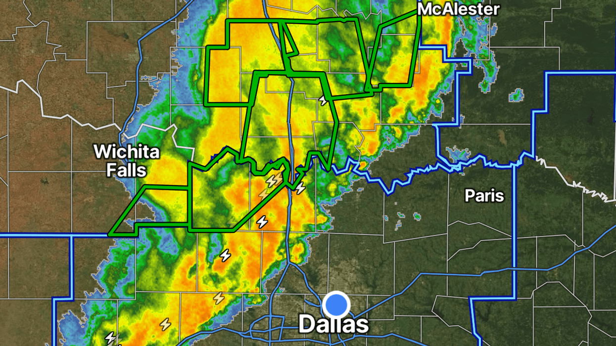

A flood watch remains in effect through Friday morning for much of North and Central Texas as the remnants of Hurricane Polo keep feeding heavy rain into the region.
The National Weather Service in Fort Worth said the watch covers areas mainly along and west of Interstate 35, including Dallas, Tarrant, Collin, Denton and Johnson counties, and reaches south toward Waco, Temple and Killeen. Slow-moving showers and storms are expected to bring a widespread 2 to 3 inches of rain, with localized totals up to 5 inches. Excessive runoff could flood creeks, streams, low-lying spots and low-water crossings. Forecasters are telling people in flood-prone areas to monitor later updates and be ready to act if a warning is issued.
The moisture is tied to what is left of Polo. The Weather Prediction Center said an airmass linked to the former Eastern Pacific hurricane is pushing unusually high moisture across the Plains, and it has placed a moderate risk of excessive rainfall over parts of the southern Plains, including the Interstate 35 corridor from Dallas-Fort Worth toward Austin and San Antonio. Rainfall rates of 1 to 2 inches an hour are possible.
A Flood Watch is in effect for much of North and Central TX from this afternoon through Friday morning. Average rainfall totals between 1.5 and 3 inches of rain are expected with isolated higher amounts up to 5 inches possible through Friday morning. #dfwwx #ctxwx pic.twitter.com/RmIBqMytmF
— NWS Fort Worth (@NWSFortWorth) September 30, 2026
Rain was already falling in downtown Dallas by midafternoon Wednesday. The Dallas Morning News reported that National Weather Service meteorologist Allison Prater said the heaviest rain was expected Wednesday night into Thursday morning, with more scattered showers and storms Thursday and Friday. She said flash flooding is the main threat, and that a more isolated risk of damaging wind, large hail or a brief tornado is also possible. Prater urged drivers not to cross flooded roads because they cannot tell whether the pavement has washed out or how deep the water is.
Cities and the state were already staging for that. Fort Worth had handed out 1,500 free sandbags by 9:30 a.m. Wednesday. Dallas Water Utilities crews were checking flood-prone spots, pump stations and storm drains, and the city is tracking rain with more than 80 gauges. Dallas Fire-Rescue has swift-water teams at Station 59 on North Jim Miller Road and Station 30 on Zodiac Lane. TxDOT and the North Texas Tollway Authority have crews on standby. Gov. Greg Abbott said earlier this week that the State Emergency Operations Center would run around the clock, and that the state had deployed 1,900 responders and more than 1,500 pieces of equipment, including high-water vehicles and rescue boats.
LISTEN on the Audacy App
Tell your Smart Speaker to "PLAY 1080 KRLD"
Sign Up to receive our KRLD Insider Newsletter for more news
Follow us on Facebook | Twitter | Instagram | YouTube