
Tropical Storm Edouard is expected to strengthen today and could approach hurricane intensity as it makes landfall near the Texas-Louisiana Gulf Coast, the National Hurricane Center said in its 4 a.m. CDT Tuesday advisory. Storm surge warnings remain in effect along the immediate coast. The storm’s leftovers may bring scattered rain to parts of North Texas by Thursday, according to the National Weather Service in Fort Worth.
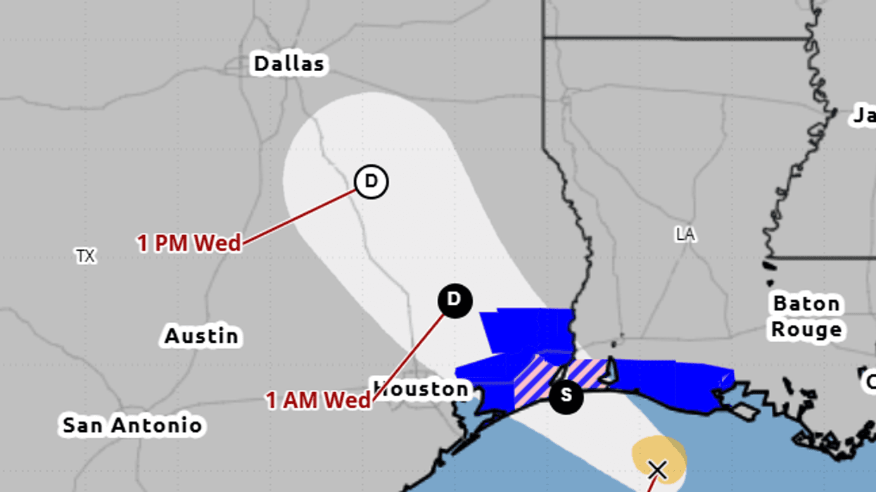
As of 4 a.m., the National Hurricane Center said Edouard was centered about 90 miles southeast of Port Arthur and 65 miles south-southeast of Cameron, Louisiana, with maximum sustained winds of 40 mph. The storm was moving west-northwest at 8 mph. Forecasters said significant strengthening is likely before the center reaches the northwest Gulf Coast later today and moves inland over southeast Texas tonight.
A storm surge warning is in effect from High Island, Texas, to the Vermilion/Cameron Parish line in Louisiana, where the National Hurricane Center said peak surge of 3 to 5 feet above ground is possible. A hurricane watch covers High Island to Cameron. A tropical storm warning stretches from Port Bolivar, Texas, to the Vermilion/Iberia Parish line. The center said tropical-storm conditions are expected along the warning area later this morning, with hurricane conditions possible in the watch area later today.
Tropical Depression Five is currently in the Gulf, and is expected to move WNW into the Upper Texas coast, bringing increased moisture and rain chances to our E/SE counties late Tue-Thu. Rain totals of 0.25-1" are expected, though isolated totals may get up to 2". #ctxwx #txwx pic.twitter.com/JYFQMLXvtw
— NWS Fort Worth (@NWSFortWorth) August 31, 2026
Rain is the main inland threat. The National Hurricane Center forecasts 3 to 6 inches from the upper Texas coast through east-central Texas, with isolated totals up to 9 inches. Flash flooding is likely in urban and low-lying areas, and river flooding is possible. A tornado or two is possible this afternoon and evening over parts of southeast Texas and southwest Louisiana, the center said. Rapid weakening is expected after the storm moves inland.
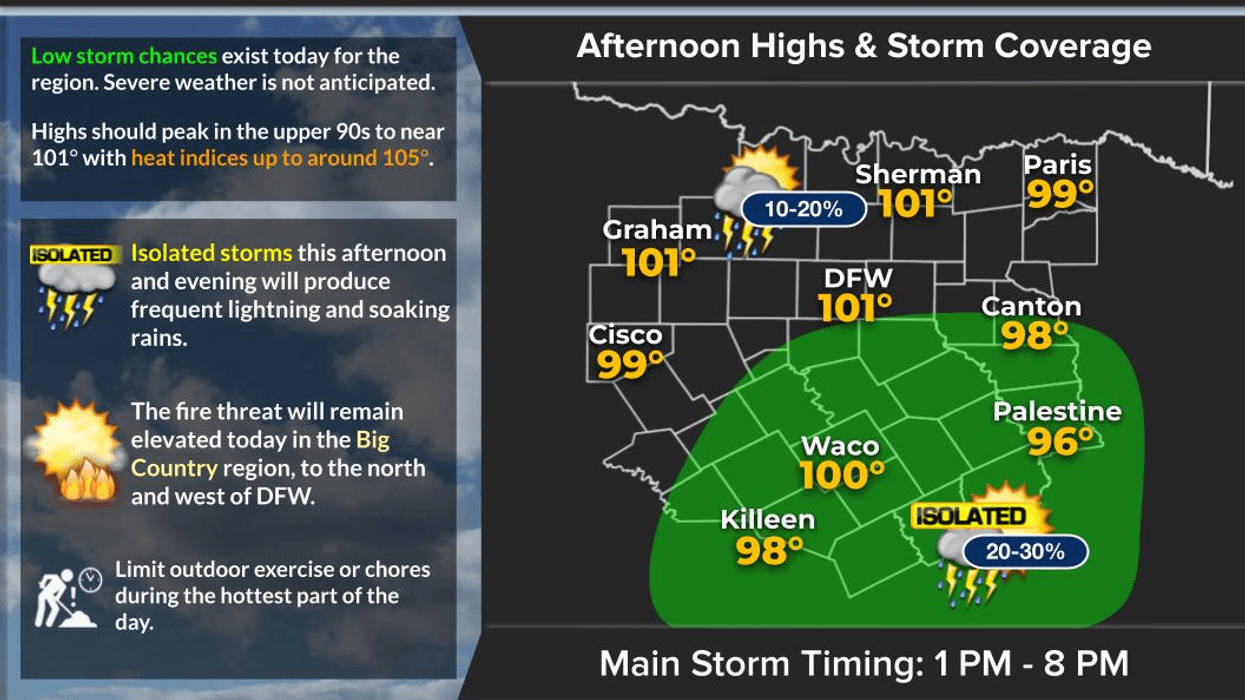
North Texas is not in the warning area and is not expected to see tropical-storm winds. The National Weather Service office in Fort Worth said remnant moisture should raise rain chances mainly in eastern and southeastern counties from late Tuesday through Thursday, with coverage peaking in the afternoon and evening. Most likely amounts in southeast Central Texas are a quarter-inch to 1 inch, with isolated totals up to 2 inches. Western North Texas rain chances remain around 10% or less, and the weather service said not everyone will see meaningful rain.
That leftover moisture would still be welcome. The National Weather Service said Dallas-Fort Worth Airport’s rainless streak is now among the 10 longest on record, and August 2026 measured only a trace of rain at the official site. Cloud cover and higher humidity should slightly ease the heat even if totals stay light, though heat indices may still climb into the 90s and triple digits.
Texas emergency officials said flooding is the top concern on the coast. No storm-related deaths or injuries had been reported as of early Tuesday.
LISTEN on the Audacy App
Tell your Smart Speaker to "PLAY 1080 KRLD"
Sign Up to receive our KRLD Insider Newsletter for more news
Follow us on Facebook | Twitter | Instagram | YouTube