Buffalo, N.Y. (WBEN) - Don't let the grass and milder temperatures fool you as we open a weekend in Buffalo and Western New York that is certain to be impactful from a weather standpoint.
"We have a front that's going through this morning, and that's going to bring much cooler air and change things over to snow," National Weather Service meteorologist Kirk Apfel tells WBEN on Saturday morning.
Things begin to change Saturday afternoon.
Apfel says the lake effect snow band will begin to form in an unorganized way across the Buffalo metro area and areas to the North first.
"But as that band intensifies, it's going to drop South across the Buffalo metro area this afternoon and settle into the Southtowns and ski country this evening and tonight."
That band will intensify to snowfall rates of about 2 inches an hour with whiteout conditions, Apfel says.
On the move
Things begin to change again late Saturday night as the snow band is forecast to be on the move again, this time Northward and again across the Buffalo metro area, reaching as far North as Niagara Falls on Sunday morning, before again dropping Southward during the day Sunday.
"It's going to be a moving band," Apfel says. "The bottom line is you're not going to want to be driving in this band, because winds are going to be so strong, there's going to be a lot of blowing and drifting in addition to the heavy snowfall rates."
The band is expected to be most intense late Saturday and into Sunday.
Accumlations
Due to the motion of the band, it will be difficult to predict exact snowfall totals for any one location.
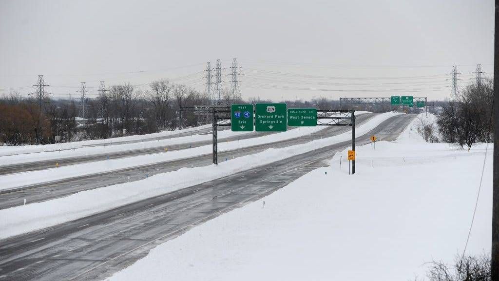
"We're looking for 1-to-2 feet, and the hardest hit areas up to 3 feet," Apfel says. "Those areas are going to include the Buffalo Southtowns, the Boston and Wyoming hills and extending into most of the Buffalo metro area."
Apfel notes the Buffalo area can expect in excess of a foot of snow from the storm after all is said and done.
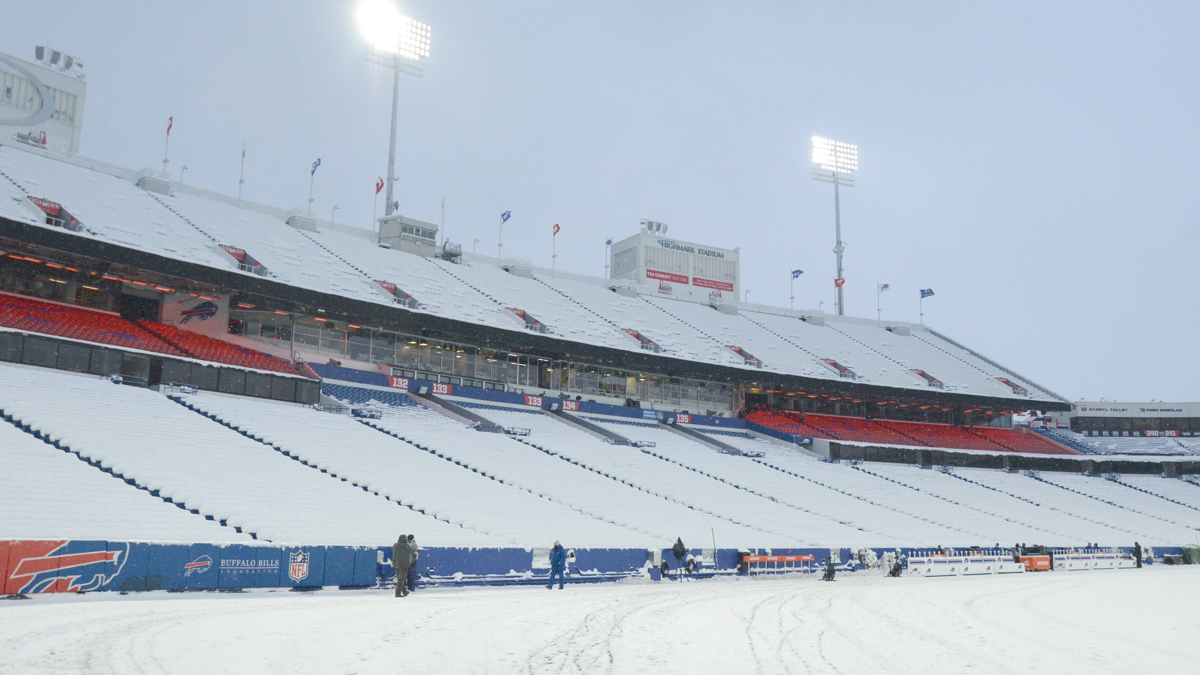
Bills Wild Card Game
Pinpointing the exact timing at 1 p.m. EST for the Buffalo Bills - Pittsburgh Steelers game is a challenge at this point.
"It's going to be in the area or potentially passing through ... there is no doubt there will eb an intense snow band somewhere in the vicinity," Apfel says.
The band is expected to be North of Buffalo in the morning hours, then passing Southward across the Buffalo metro area during the day Sunday.
When will it all end?
It'll be a long weekend of lake effect on the move. "Things are finally going to start winding down late Sunday night and Monday and it's going to become a little less intense. Winds will diminish during that time period as well.
Warnings
A Winter Storm Warning (see below) is posted for ALL of Western New York. For the Buffalo metro area it runs from Saturday morning through Monday morning. For the Northern areas of Western New York, the warning is expected to expire Sunday afternoon.
A High Wind Warning (see below) is posted for ALL of WNY late Friday through early Sunday morning.
A Lakeshore Flood Warning (see below) is also posted for the Lake Erie shoreline in Erie and Chautauqua counties.
WINTER STORM WARNING REMAINS IN EFFECT FROM 10 AM THIS MORNING TO 7 AM EST MONDAY
* WHAT...Heavy lake effect snow and very strong winds expected.
Total snow accumulations of 1 to 2 feet in the most persistent lake snows, with local amounts 2 to 3 feet where the bands persist the longest. Winds gusting as high as 65 mph early in the event will diminish somewhat late tonight. Blizzard conditions will be possible at times, especially tonight and Sunday.
* WHERE...Erie, Genesee, and Wyoming counties.
* WHEN...From 10 AM Saturday to 7 AM EST Monday. The band of heavy lake effect snow is expected to oscillate north and south several times through the course of the event, resulting in varying conditions over time.
* IMPACTS...Travel will be very difficult to impossible at times with deep snow cover on roads. Widespread blowing snow will reduce visibility to near zero in lake effect bands. Very strong winds could cause extensive tree and powerline damage.
PRECAUTIONARY/PREPAREDNESS ACTIONS...
Heavy snow will fall in relatively narrow bands and this combined with blowing snow will reduce visibility to near zero. Travel will be extremely difficult to impossible in heavy lake effect bands.
Travel within lake effect bands will be extremely dangerous tonight and Sunday.
WINTER STORM WARNING REMAINS IN EFFECT FROM 10 AM THIS MORNING TO 3 PM EST SUNDAY
* WHAT...Heavy lake effect snow and very strong winds expected.
Total snow accumulations of 5 to 10 inches in the most persistent lake snows. Winds gusting as high as 65 mph this afternoon and evening, but the heaviest snow will be late tonight into early Sunday morning when winds will be gusting to 45 mph. Blizzard conditions will be possible at times late tonight into early Sunday morning.
* WHERE...Niagara and Orleans counties, especially southern portions of the counties.
* WHEN...From 10 AM Saturday to 3 PM EST Sunday. The band of heavy lake effect snow is expected to oscillate north and south several times through the course of the event, resulting in varying conditions over time.
* IMPACTS...Travel will be very difficult with snow covered roads.
Widespread blowing snow will significantly reduce visibility to near zero in lake effect bands. Strong winds could cause tree and powerline damage.
PRECAUTIONARY/PREPAREDNESS ACTIONS...
Heavy snow will fall in relatively narrow bands. If traveling, be prepared for rapidly changing road conditions and visibilities.
WINTER STORM WARNING REMAINS IN EFFECT FROM 10 AM THIS MORNING TO 7 AM EST MONDAY
* WHAT...Heavy lake effect snow and strong winds expected. Total snow accumulations of 8 to 16 inches in the most persistent lake snows. Winds gusting as high as 60 mph early in the event will diminish somewhat late tonight. Blizzard conditions will be possible at times.
* WHERE...Chautauqua and Cattaraugus counties. Greatest snow amounts over the far northern portions of the counties.
* WHEN...From 10 AM Saturday to 7 AM EST Monday. The band of heavy lake effect snow is expected to oscillate north and south several times through the course of the event, resulting in varying conditions over time.
* IMPACTS...Travel will be very difficult. at times with snow covered roads. Widespread blowing snow could lower visibility to near zero at times. Strong winds could cause tree and powerline damage.
PRECAUTIONARY/PREPAREDNESS ACTIONS...
Heavy snow will fall in relatively narrow bands. If traveling, be prepared for rapidly changing road conditions and visibilities.
HIGH WIND WARNING REMAINS IN EFFECT UNTIL 4 AM EST SUNDAY
* WHAT...Southwest winds 30 to 40 mph with gusts up to 65 mph.
* WHERE...Niagara, Orleans, Monroe, Northern Erie, and Genesee counties.
* WHEN...Until 4 AM EST Sunday.
* IMPACTS...Damaging winds will blow down trees and power lines.
Widespread power outages are expected. Travel will be difficult, especially for high profile vehicles.
PRECAUTIONARY/PREPAREDNESS ACTIONS...
People should avoid being outside in forested areas and around trees and branches. If possible, remain in the lower levels of your home during the windstorm, and avoid windows. Use caution if you must drive.
LAKESHORE FLOOD WARNING REMAINS IN EFFECT FROM 7 AM THIS MORNING TO 4 AM EST SUNDAY.
* WHAT...Significant lakeshore flooding expected. Rapid rises are expected this morning with the highest levels this afternoon and early evening.
* WHERE...Lake Erie shore of Erie, and Chautauqua counties.
Upper Niagara River shore of Erie and Niagara counties.
* WHEN...From 7 AM Saturday to 4 AM EST Sunday.
* IMPACTS...The rapid rise in water levels will result in lakeshore flooding along the Lake Erie shore. This includes Dunkirk Harbor and Pier, Sunset Bay, Route 5 in Hamburg, Buffalo Harbor, and Canalside. Flooding is also possible along the Upper Niagara River shore. Along the Upper Niagara River, flooding is likely to affect Grand Island and Cayuga Island.
PRECAUTIONARY/PREPAREDNESS ACTIONS...
A Lakeshore Flood Warning means lakeshore flooding is occurring, is imminent, or is expected to occur. For your safety, stay off breakwaters, piers, rock outcroppings and beaches! Waves are often larger than they appear and can easily wash you away.
Expect significant beach erosion and debris, local road closures and extremely dangerous boating conditions.