

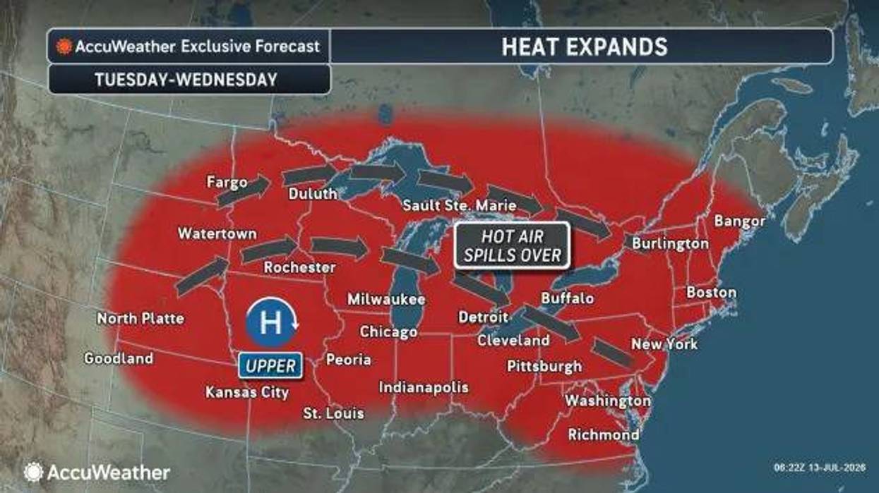

Buffalo, N.Y. (WBEN) - Another round of heat rolls into WNY to start the work week. A Heat Advisory is posted for all of WNY Tuesday, though thankfully this event will be much shorter than what the region experienced two weeks ago.
"We're gonna warmup today, but the humidity levels are gonna remain pretty low so it's not gonna feel that hot out there," National Weather Service meteorologist Jim Mitchell told WBEN Monday morning.
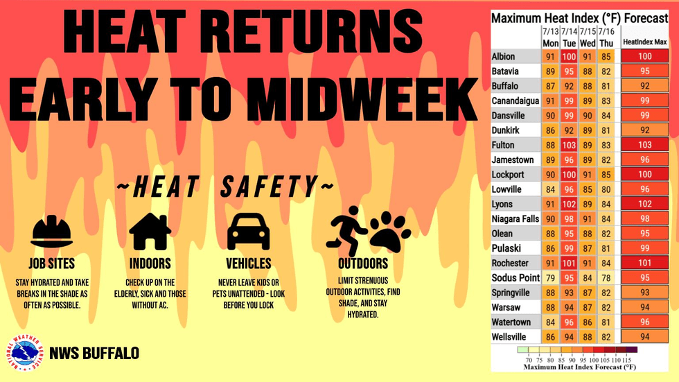 National Weather Service
Heat index values Monday will hit 87 in Buffalo and 90 northward, including Niagara Falls and Lockport. Tuesday will be the worst of it.
"It'll be mid-90s to upper-90s over just about all of WNY...as you go up towards Niagara County north of the escarpment you're looking at possibly in the low 100s for heat index values," Mitchell says.
A cold front will arrive Wednesday and bring some relief. By Thursday heat index values across the region will range from 80-85.
HEAT ADVISORY IN EFFECT FROM 11 AM TO 8 PM EDT TUESDAY
* WHAT...Heat index values of 95 to 100 across much of western and north central NY, with as high as 104 possible across the lake plains, Genesee Valley, and Finger Lakes region.
* WHERE...All of western and north central New York.
* WHEN...From 11 AM to 8 PM EDT Tuesday.
* IMPACTS...Hot temperatures and high humidity may cause heat related illnesses to occur.
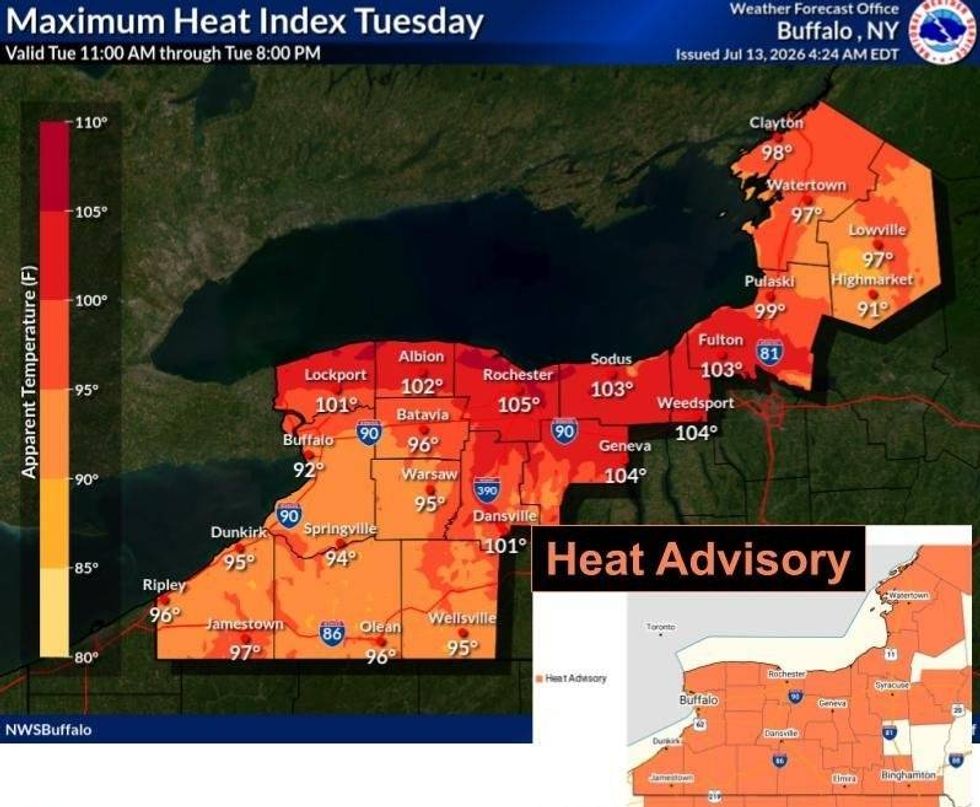 National Weather Service


