Erie, Pa. (WBEN) - An unmanned Saildrone is crossing Lake Erie this summer. It's studying fish populations, as Lake Erie is home to a world class fishery.
The Saildrone was launched from Erie, Pennsylvania on July 14.
It first headed to the Western basin, then central basin before coming to the Eastern basin, circumnavigating the lake in a clockwise direction through the end of September.
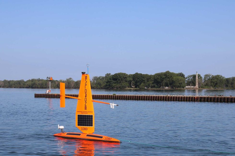
"It's a relatively large uncrewed surface vehicle, said Fisheries Biologist Mark DuFour with the U. S. Geological Survey. "It's 23 feet long and has a 15-foot bright orange sail."
The drone has environmental sensors on its surface and below the water. Biologists are especially interested in the fishery acoustic data that it's collecting.
"It's highly visible, but moves fairly slow, so it's easy for boaters to avoid," added DuFour. "We would just ask folks to maintain a safe 15-hundred foot distance from it."
He noted that habitat conditions are quite different in the western end of Lake Erie, versus the eastern end.
 USGS
USGS
"Each end of the lake has different habitat conditions. In the west basin, we're interested in how harmful algae blooms move fish around. In the central basin, we're interested in hypoxia, and in the eastern basin we're interested in
cold water habitat."
A lot of data is being collected. DuFour is hoping that it helps improve existing fisheries.
The drone is completely autonomous. It's movement is powered by wind and its sensors are powered by solar energy which operate the positioning of the sail and rudder.
"We're currently in the central basin. We should be moving toward the eastern basin around August 24. And we will be operating primarily between Erie and Dunkirk, in both U.S. and Canadian waters," said DuFour.