Buffalo, N.Y. (WBEN) - The weather across the Buffalo-Niagara region this week makes a dramatic shift from a summer of "sweating it out" to "sweatshirt season", as a cool and unsettled week of weather unfolds in advance of Labor Day Weekend.
"It's going to be awfully cool," National Weather Service meteorologist Aaron Reynolds tells WBEN of Monday. "Highs are only going to be in the 60s, to right around 70, to the low 70s."
Scattered showers and a few thunderstorms are possible Monday as well, with lake effect rain showers East and Southeast off both lakes.
A cool night Monday is expected, with mercury readings falling back into the 50s just inland from the lakes to a range of 40s elsewhere.
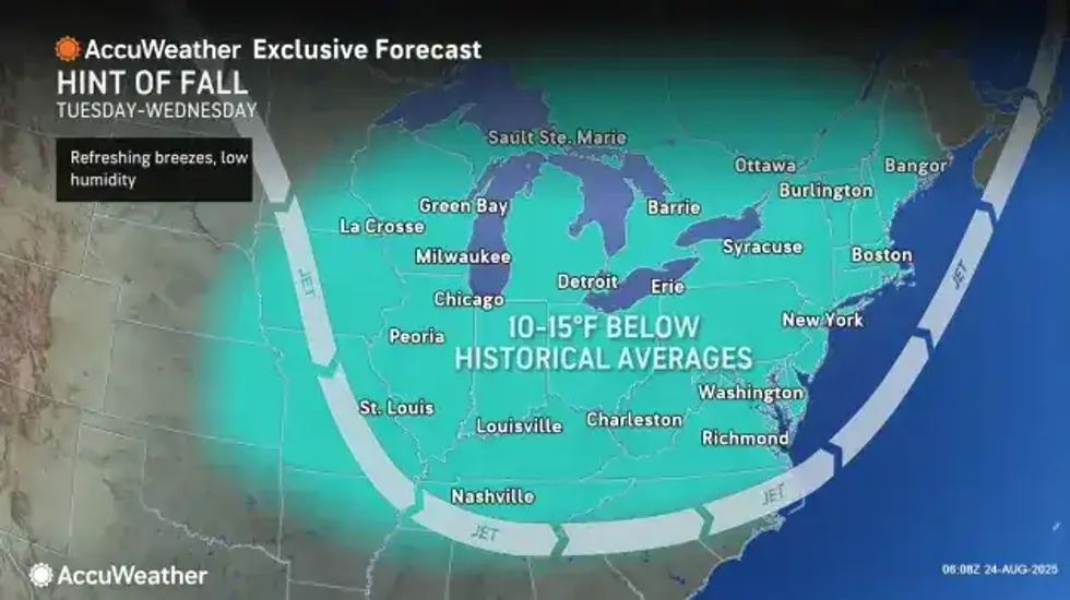
The lake effect rain showers will remain in the forecast through Wednesday, along with the cooler than normal temperatures, forecasters say. The showers during the period, Reynolds tells us, will be "hit or miss" in nature.
 AccuWeather
A cold front will move across the region Thursday and Thursday Night, bringing renewed chances for showers and thunderstorms, while reinforcing the cooler airmass over our region. The pattern will likely make way for below normal temperatures through the end of this month.
"It's going to be cool all week, but it does look like there's a trend toward the weekend to be a little bit warmer," Reynolds said.