
Buffalo, N.Y. (WBEN) - As promised, a line of lake effect snow developed over the metro Buffalo area quickly Wednesday evening, leaving a blanket of white across the region that plows have since cleared from roadways.
The band of lake effect snow almost immediately began its anticipated southward trek and crossed through the southtowns and will target the southern tier Thanksgiving Day and through Friday.
"Areas around the City of Buffalo and into the northtowns saw 2 to 3 inches of heavy, wet snow," National Weather Service meteorologist Heather Kenyon tells WBEN. "But overnight, that band slowly drifted south."
At the Buffalo Airport, just over two inches of snow was recorded, Kenyon says.
Forecasters say the lake snows will concentrate across the higher terrain inland from the lake, including the Boston Hills, western Wyoming County, and the ridges of the western Southern Tier. Winds will carry lake snows all the way inland into Allegany County where decent accumulations are anticipated through Friday.
Overall...snowfall totals of 12-20" will be possible within the most persistent snows, with locally higher amounts in spots.
A number of advisories remain posted for the region:
A Winter Weather Advisory for northern Erie, Niagara, Orleans and Genesee counties through 1 p.m. Thanksgiving Day.
A Wind Advisory for the Buffalo metro and most of WNY through early Friday.
A Lake Effect Snow Warning for southern Erie, Wyoming, Chautauqua, Cattaraugus and Allegany counties through early Friday.
It will remain windy for all of Western New York, however areas not impacted by the main lake effect bands will only see periodic snow showers with some minor accumulations and brief reduced visibilities through Friday.
The Buffalo Skyway remains closed due to the high wind gusts.
Buffalo AccuWeather Radar

WINTER WEATHER ADVISORY REMAINS IN EFFECT FROM 9 PM THIS EVENING TO 1 PM EST THURSDAY
* WHAT...Lake effect snow expected. Total snow accumulations 2 to 4 inches in the most persistent lake snows. Winds gusting as high as 55 mph will produce blowing and drifting snow.
* WHERE...Northern Erie and Genesee Counties.
* WHEN...From 9 PM this evening to 1 PM EST Thursday.
* IMPACTS...Plan on slushy and slippery road conditions and reduced visibility. The hazardous conditions will impact Thanksgiving holiday travel. Gusty winds will down tree branches and cause isolated power outages.
PRECAUTIONARY/PREPAREDNESS ACTIONS...
Lake effect snow will fall in relatively narrow bands. If traveling, be prepared for rapidly changing road conditions and visibilities.
WINTER WEATHER ADVISORY REMAINS IN EFFECT FROM 7 PM THIS EVENING TO 7 AM EST THURSDAY
* WHAT...Lake effect snow expected. Total snow accumulations 3 to 5 inches in the most persistent lake snows. Winds gusting as high as 55 mph will produce blowing and drifting snow.
* WHERE...Niagara and Orleans Counties.
* WHEN...From 7 PM this evening to 7 AM EST Thursday.
* IMPACTS...Plan on slushy and slippery road conditions with reduced visibility. The hazardous conditions will impact Thanksgiving holiday travel. Gusty winds will down tree branches and cause isolated power outages.
PRECAUTIONARY/PREPAREDNESS ACTIONS...
Lake effect snow will fall in relatively narrow bands. If traveling, be prepared for rapidly changing road conditions and visibilities.
WIND ADVISORY REMAINS IN EFFECT UNTIL 1 AM EST FRIDAY
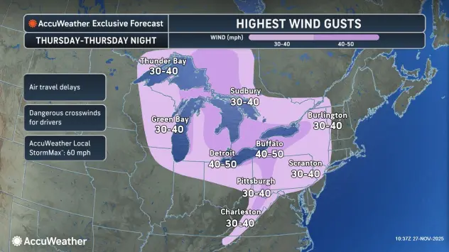
* WHAT...Southwest winds 30 to 40 mph with gusts of 50 to 55 mph expected this afternoon through tonight. West winds 25 to 35 mph with gusts of 45 to 50 mph expected Thursday through Thursday night.
* WHERE...Erie, Niagara, Orleans, Genesee, Wyoming, and Chautauqua Counties.
* WHEN...Until 1 AM EST Friday.
* IMPACTS...Gusty winds will blow around unsecured objects. Tree limbs could be blown down and a few isolated power outages may result.
LAKESHORE FLOOD WARNING IN EFFECT UNTIL 10 AM EST THURSDAY
* WHAT...Lakeshore flooding expected.
* WHERE...Lake Erie shore of Erie and Chautauqua counties.
* WHEN...Until 10 AM EST Thursday.
* IMPACTS...The rapid rise in water levels at the eastern end of Lake Erie will result in lakeshore flooding along the Lake Erie shore. Flooding is likely along Route 5 in Hamburg, Buffalo Harbor and Canalside, Dunkirk Harbor, and other flood prone locations. Very high wave action will also result in shoreline erosion.
PRECAUTIONARY/PREPAREDNESS ACTIONS...
A Lakeshore Flood Warning means lakeshore flooding is occurring, is imminent, or is expected to occur. For your safety, stay off breakwaters, piers, rock outcroppings and beaches! Waves are often larger than they appear and can easily wash you away.
Expect significant beach erosion and debris, local road closures and extremely dangerous boating conditions.
LAKE EFFECT SNOW WARNING REMAINS IN EFFECT FROM 1 AM THURSDAY TO 1 AM EST SATURDAY
* WHAT...Heavy lake effect snow expected. Total snow accumulations 12 to 22 inches in the most persistent lake snows. Winds gusting as high as 50 mph will produce blowing and drifting snow.
* WHERE...Jefferson, Lewis, Wyoming, Chautauqua, Cattaraugus, and Southern Erie Counties. The greatest accumulations off Lake Erie will be found across the higher terrain of the Chautauqua Ridge, Boston Hills, and southwest Wyoming County. The greatest accumulations off Lake Ontario will be found across the Tug Hill Plateau.
* WHEN...From 1 AM Thursday to 1 AM EST Saturday.
* IMPACTS...Travel will be very difficult with deep snow cover on roads and poor visibility. The hazardous conditions will impact Thanksgiving holiday travel. Gusty winds will down tree branches and cause isolated power outages.
PRECAUTIONARY/PREPAREDNESS ACTIONS...
Heavy snow will fall in relatively narrow bands. If traveling, be prepared for rapidly changing road conditions and visibilities.