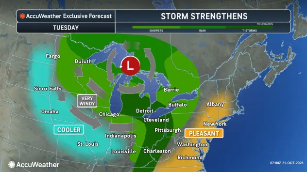

Buffalo, N.Y. (WBEN) - "A long duration lake effect rain event is on the way," National Weather Service meteorologist Phillip Pandolfo tells WBEN Tuesday morning. "We could be looking at a few inches of rain over the next few days."
Much of the day Tuesday will be relatively quiet, with just a few showers.
"The real story will start as the cold front of this system moves through the area tonight, and the lake effect rain is going to kick up behind that pretty quickly" Pandolfo cautions.
The lake effect rain band will develop over the metro Buffalo area and will oscillate north and south over the course of the next few days. "That'll be tonight, into Wednesday and into much of Thursday as well," Pandolfo says. Later Thursday and into Friday, the band will make a southward path into the southern tier.
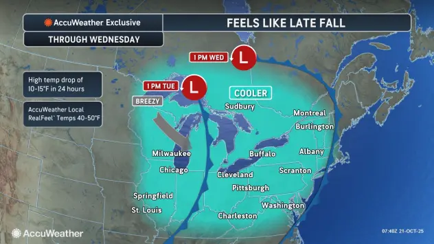
The remainder of the week will be cool as well, with daytime high temperatures below normal for the entire region.
AccuWeather Radar for Buffalo metro area

How Much Rain?
In general, a few inches of rainfall is possible across the area.
"The highest amounts are going to be closer to Lake Erie, particularly immediately east and southeast of the lake," Pandolfo warns. "This is all the way through Friday, so we're not going to be looking at several inches of rain over the course of a few hours."
For the Buffalo metro area, 2 to 3 inches of rain is in the forecast, however that could be higher depending on the fluctuation of the band.
As for the potential for flooding, Pandolfo says poor drainage flooding is possible, however widespread flooding is not expected, given the amount of rainfall and duration of it.