
Buffalo, N.Y. (WBEN) - One more day of extreme cold conditions across the Buffalo-Niagara region are in the Sunday forecast, before a less harsh weather pattern settles-in for the coming work week, National Weather Service forecasters say.
A Cold Weather Advisory and Extreme Cold Warning will expire Sunday, however an advisory may well be added for another night of bitter cold Sunday into Monday.
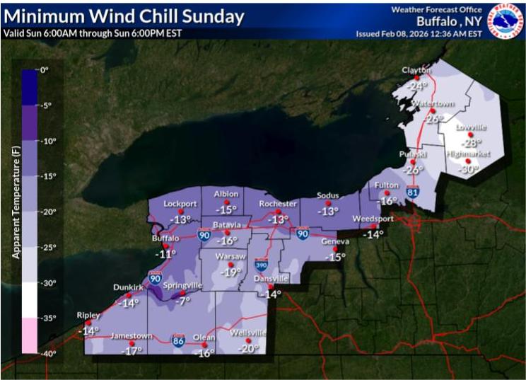
Dangerously cold wind chills between 15 and 35 below zero began the day Sunday across much of the Western New York region, however temperatures will climb back into the single digits through the day and wind chills will improve through daylight hours as well.
"Expect highs really in the mid to upper single digits(Sunday)," NWS meteorologist Steven Welch tells WBEN. "Low to mid single digits for the higher terrain."
Clearing and light winds over fresh snowpack will support temperatures falling well below advisory levels before a new weather system moves in for the start of the work week with a less harsh airmass expected to start the work week.
Temps will be more seasonable Monday, in the upper teens to near 20, Welch says.
"A more noticeable warmup should be expected Tuesday," Welch tells us. "We actually break the freezing mark for the first time in quite a while, with most areas of WNY reaching the mid 30's."