
Buffalo, N.Y. (WBEN) - As has been the case with recent weather systems, lake effect snow targeting Western New York will only be an issue for the Buffalo metro area for a brief amount of time this weekend.
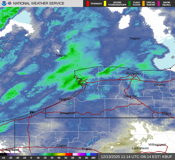
Lake enhanced snow will develop early Saturday across Niagara County ahead of an arctic cold front, with a quick few inches of snow possible northeast of Lake Erie through early this afternoon as the front crosses the region
National Weather Service forecasters say the arctic front will cross the region Saturday, pushing the band of lake enhanced snows further south and east across the area, into the Boston Hills and Southern Tier by midday.

Expect a burst of snow northeast of Lake Erie, with a quick of 1-3 inches of snow possible across the Buffalo metro area during the mid to late morning hours.
The band will weaken as it moves further east and southeast as it loses lake influences. Winds quickly shift west in the wake of the frontal passage with lake effect snows setting up east of the lake later this afternoon through tonight.
A Lake Effect Snow Warning remains in effect for Southern Erie, Chautauqua, and Cattaraugus counties. Expect localized snowfall amounts of 3-5 inches from late this afternoon through tonight in the most persistent snows, with much less elsewhere.
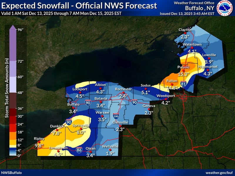
Additional accumulations Sunday through Sunday evening will be in the 2-4"/3-5" range across the higher terrain. This will bring totals into the 8-12" range in locations where bands persist the longest, most likely on the Chautauqua Ridge and Boston Hills.
A work week warmup is in store, however, with a weather system bringing warmer air by Thursday and temps will rise well into the 40's, with even some potential for 50's.
LAKE EFFECT SNOW WARNING REMAINS IN EFFECT FROM 7 AM THIS MORNING TO 7 AM EST MONDAY
* WHAT...Heavy lake effect snow expected. Total snow accumulations 6 to 12 inches in the most persistent lake snows. Winds gusting as high as 35 mph will produce blowing and drifting snow in open areas.
* WHERE...Chautauqua, Cattaraugus, and Southern Erie Counties. The greatest accumulations will focus across the higher terrain of the Chautauqua Ridge and Boston Hills, while remaining well south of the Buffalo Southtowns.
* WHEN...From 7 AM this morning to 7 AM EST Monday.
* IMPACTS...Travel will be very difficult at times with snow covered roads and poor visibility.
PRECAUTIONARY/PREPAREDNESS ACTIONS...
Heavy snow will fall in relatively narrow bands. If traveling, be prepared for rapidly changing road conditions and visibilities.