
Buffalo, N.Y. (WBEN) - After a cold start Sunday and lake effect snow concentrating across the southern tier, a new weather system will move southeast across the lower Great Lakes Monday and Monday night setting the stage for one last round of localized moderate to heavy lake snows
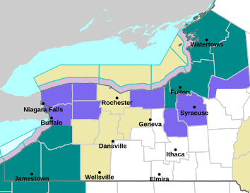
While a Lake Effect Snow Warning remains in effect for Southern Erie, Chautauqua, and Cattaraugus counties through Monday morning, a Winter Weather Advisory has now been posted for the metro Buffalo area.
Expect the initial lake band to form Monday morning east of the lake across Southern Erie, western Wyoming, and northern Portions of Chautauqua and Cattaraugus counties, before lifting north across the Niagara Frontier including the Buffalo metro area and intensifying. The band will peak in intensity Monday afternoon, forecasters say.

As the band swings north Monday afternoon, 2-4 inches will be possible across the Niagara Frontier centered on areas south and east of Niagara Falls including the Buffalo metro area, likely impacting the evening commute.
WINTER WEATHER ADVISORY IN EFFECT FROM 10 AM MONDAY TO 7 AM EST TUESDAY NORTHERN NIAGARA FRONTIER
* WHAT...Lake effect snow expected Northern Niagara Frontier. Total snow accumulations 3 to 6 inches in the most persistent lake snows.
* WHERE...Niagara, Orleans, Northern Erie, and Genesee Counties.
* WHEN...From 10 AM Monday to 7 AM EST Tuesday.
* IMPACTS...Plan on slippery road conditions. The hazardous conditions will impact the Monday evening and Tuesday morning commutes with snow covered roads.
PRECAUTIONARY/PREPAREDNESS ACTIONS...
Lake effect snow will fall in relatively narrow bands. If traveling, be prepared for rapidly changing road conditions and visibilities.
LAKE EFFECT SNOW WARNING REMAINS IN EFFECT UNTIL 7 AM EST MONDAY
* WHAT...Heavy lake effect snow. Additional snow accumulations 4 to 8 inches in the most persistent lake snows across higher terrain.
* WHERE...Chautauqua, Cattaraugus, and Southern Erie Counties. The greatest accumulations will focus across the Chautauqua Ridge and Boston Hills.
* WHEN...Until 7 AM EST Monday.
* IMPACTS...Travel will be difficult with snow covered roads and poor visibility.
PRECAUTIONARY/PREPAREDNESS ACTIONS...
Heavy snow will fall in relatively narrow bands. If traveling, be prepared for rapidly changing road conditions and visibilities.