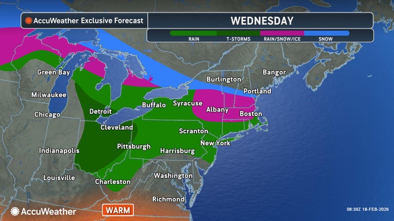

Once again, an active weather pattern has descended upon the Buffalo-Niagara and Western New York region, with a mix of rain, snow, and potentially freezing rain at times in the forecast for much of the area Wednesday.
A Winter Weather Advisory has been expanded to include the metro Buffalo area and northern Erie County, along with Niagara, Orleans, Genesee and Wyoming counties through early Thursday.
With an area of rain moving into the region and temperatures hovering at the freezing mark across northern portions of the region, freezing rain is a possibility for the areas covered by the advisory. "Icing up to a quarter inch or more," is a possibility, according to National Weather Service meteorologist Dave Thomas.
"We're looking for like the City of Buffalo, the Buffalo Airport, those areas and southward should just be plain rain," Thomas tells WBEN. "Tonawanda, Amherst could see a few hundredths, and especially when you cross that line into Niagara County, that's where we could see the more significant icing of up to a quarter, or even more, of an inch."
Thomas cautions some isolated tree and power line damage is a possibility from freezing rain today across the areas along the Lake Ontario shoreline.
For the areas to the south that will experience all rain Wednesday, some significant precipitation is in the forecast. "We're looking for a half, to as much a three quarters of an inch of rainfall, and that combined with snow melt will allow for backyard ponding of water...and even som potential for some ice jams as well," Thomas cautions.
Another round of widespread precipitation is in the forecast for later this week, with primarily rain across WNY Friday, changing over to light snowfall Friday night, potentially lingering into the weekend.
WINTER WEATHER ADVISORY REMAINS IN EFFECT UNTIL 1 AM EST THURSDAY
* WHAT...Areas of freezing rain expected. Total ice accumulations of a few hundredths to around one quarter of an inch.
* WHERE...Northern Erie and Wyoming Counties. The greatest ice accumulations are expected across the hilltops of northern Wyoming County.
* WHEN...Until 1 AM EST Thursday.
* IMPACTS...Plan on slippery road conditions. The hazardous conditions will impact the Wednesday morning and evening commutes.
* ADDITIONAL DETAILS...The highest risk for freezing rain in Erie County will be north of the Buffalo Airport and I-90, with a minimal risk for freezing rain across the City of Buffalo. Across Wyoming County, the freezing rain should remain isolated to the hilltops across the northern half of the county.
PRECAUTIONARY/PREPAREDNESS ACTIONS...
Periods of freezing rain will result in slippery surfaces. Slow down and use caution while driving.