METRO DETROIT (WWJ) - Meteorologists say hazardous conditions will continue to impact Southeast Michigan until the early afternoon hours as heavy snow squalls move into the region.
The National Weather Service posted a special weather statement for Livingston, Oakland and Macomb Counties, to include the cities of Howell, Pontiac and Warren, until 1:15 p.m. as moderate to briefly heavy snow will cause reductions of visibility to less than one mile at times.
"Scattered snow squalls will impact the northern Metro Detroit suburbs, including the I-96, I-696, and M-59 corridors, during the late morning and early afternoon," meteorologists warned.
"The combination of moderate to heavy snow and gusty winds will result in localized white out conditions." the statement continued. "Reduced visibilities along with snow covered and slippery roads will cause variable traffic rates throughout the area."
While the Metro Detroit area is only expecting to see a dusting to an inch of snowfall between 10 a.m. and 1 p.m., experts said briefly heavier bursts of snow will see quick accumulations up to a half inch.
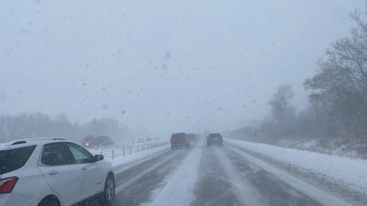
WWJ's Mike Campbell said US-23 near Fenton went from "wet to whiteout" in a matter of minutes.
"Right about at White Lake Road, so between M-59 and I-75, there was a pretty good squall I had to pass through," he warned. "By the time you get to Torrey Road, you're though the worst of the snow. It is still snowing, just not a white out at that point."
Campbell said the roads appear to be just wet, but conditions change rapidly in the squall.

"Expect for in that snow band and then it becomes very slippery. Everybody is slowing down to maybe 25 mph and then like I said, once you get to Torrey Road, you go back up to speed," he added.
The NWS said not only roadways will be affect, but accumulating snow could lead to slippery areas on bridges, exit ramps and overpasses.
"Motorists are urged to use caution and account for the variable driving conditions by allowing extra time," experts advised.
Deteriorating conditions were attributed to a major crash in Macomb County, involving multiple vehicles on I-94 at M-19. MDOT said the incident involves several semis and all eastbound lanes are blocked at this time.
Troopers said another crash that saw 40,000 lbs. of mulch spill out on US-23 from an overturned semi-truck was caused by traveling too fast for icy road conditions in Livingston County.
MSP also reports one person is dead after a vehicle lost control and flipped over on I-75 in downtown Detroit Friday morning. While conditions were icy and dangerous out on the freeway, the driver is is suspected of being drunk, police said.
In all three incidents, major freeways were gridlocked, creating a traffic nightmare for those traverse the city and into the suburbs.
WWJ traffic reporter Tina Marie said drivers should take extra precautions and head out to their destinations slowly and early as roads are proving extremely hazardous.
"We've had several reports of spin-outs across the Metro Detroit area," she advised.
As Metro Detroiters try to navigate icy roads this morning, commuters on the west side of the state are digging out after over 6" of snow fell in the region yesterday. WWJ's Jackie Paige says another half-a-foot of snow or more is still expected in the area
Keep your radio tuned to WWJ Newsradio 950 for the latest weather and traffic updates every 10 minutes on the :08s, tell you smart speaker "play WWJ nine-fifty," and download the free Audacy App and favorite WWJ.