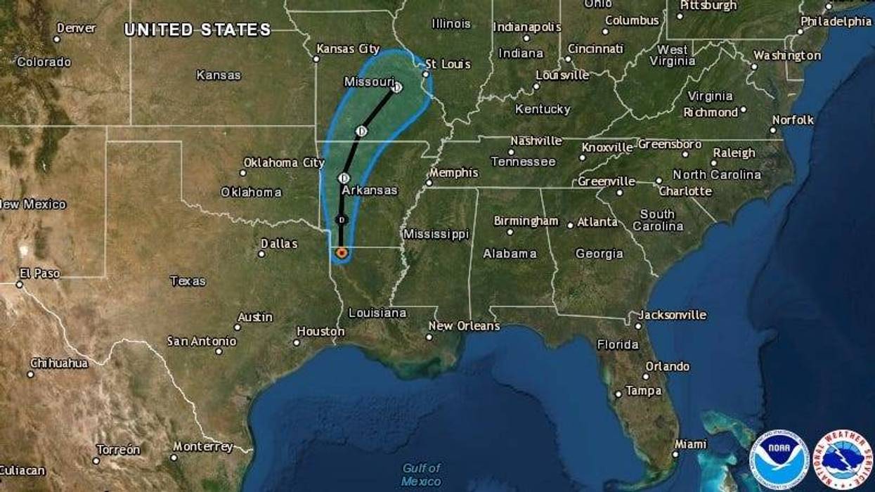
It's now Tropical Depression Barry as of Sunday afternoon, with top winds of just 35 mile per hour. The center of the storm is moving north at nine miles per hour, and will soon be over Arkansas.
Barry is now a tropical depression as of 4 p.m. Sunday. It has winds of 35 mph, moving N at 9 mph. Center is now north of Shreveport, but rain continues on the east & south sides. Flash Flood Watch continues for SE La. until 7am Monday for 2-4" of rain. pic.twitter.com/kQMRpmZGVg
— Alexandra Cranford WWL-TV (@alexandracranfo) July 14, 2019
"A motion toward the north-northeast and northeast is expected Monday afternoon into Tuesday," said Senior Hurricane Specialist Stacy Stewart at the National Hurricane Center. "On the forecast track, the center of Barry will move across the northwestern portions of Louisiana today, and over Arkansas tonight and Monday."
Like much of Barry's rain, its top winds are well off of its center.
"Maximum sustained winds have decreased to near 35 mph with higher gusts," said Stewart. "These winds are occurring near the coast well to the southeast and south of the center. Further weakening is expected as the center moves farther inland, and Barry is forecast to degenerate into a remnant low pressure system by Monday night."
A flash flood watch remains in effect for the New Orleans area through 7:00 p.m. Click here for WWL interactive radar.