A powerful thunderstorm developed over New Orleans Saturday afternoon and before too long, streets in the CBD and other areas had gone under water.
— Mady Duncan (@itsmadyyall) July 20, 2019
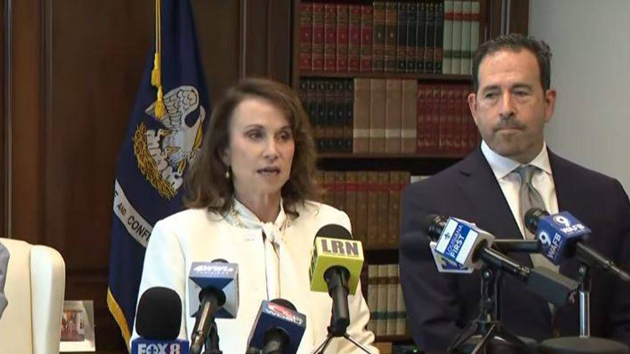
The flash flood led to many to question whether Sewerage and Water Board drainage pumps were operating.
My catch basin was cleaned this past week pic.twitter.com/iOWJIQWOyH
— Nolagrl (@1Nolagrl) July 20, 2019But unofficial measuerments indicate the rainfall fell with an intensity that the drainage system could not keep up with.
1.88 inches of rain fell in 30 minutes at the New Orleans Superdome this afternoon, the National Weather Service said. #neworleans #heavyrain #superdome @WWLTV #beon4 pic.twitter.com/6sEqulai50
— Alexandra Cranford WWL-TV (@alexandracranfo) July 20, 2019Seeing more flooding pics out of New Orleans today. If this station near Magazine & Julia (on Weather Underground) is accurate, it recorded 3.6" of rain in an hour. Even if everything is functioning, pumps can't keep up with those sorts of rain rates. #LAwx #NOLA pic.twitter.com/w8C7g6xHyN
— Steve Caparotta, Ph.D. (@SteveWAFB) July 20, 2019City officials in New Orleans notified residents via its text alert system and social media that parking restrictions were lifted for people to move their cars to higher ground.
Parking restrictions lifted until further notice. Move vehicles to neutral grounds & sidewalks. Call 911 to report major street flooding & never drive thru water. https://t.co/KqU81SC1j1
— NOLA Ready (@nolaready) July 20, 2019By early evening, chances for heavy rain had diminished.
Wondering if more downpours are coming? Most heavy rain has wrapped up for today, but scattered lighter showers could linger the next couple of hours. Most rain ends by about 7 p.m. @WWLTV #neworleans pic.twitter.com/RK4IZepLuh
— Alexandra Cranford WWL-TV (@alexandracranfo) July 20, 2019SATURDAY NIGHT:Cloudy and mild with a 20% chance for isolated showers or thunderstorms. Lows around 77. Wind SE 3-8 mph.
SUNDAY:Mostly cloudy, warm and humid with a 60% chance for scattered showers and thunderstorms. Heavy rain possible. Highs around 89. Wind SE 5-10 mph.
SUNDAY NIGHT:Partly cloudy and mild with a 20% chance for isolated showers or thunderstorms. Lows around 77. Wind SE 2-5 mph.
MONDAY:Partly to mostly cloudy, hot and humid with a 50% chance for scattered showers and thunderstorms. Highs around 90 feeling like 100. Wind SW 5-10 mph.
TUESDAY:Mostly cloudy, warm and humid with a 70% chance for showers and thunderstorms. Heavy rain possible. Lows around 76. Highs around 87.
WEDNESDAY:Mostly cloudy, warm and humid with a 40% chance for showers and thunderstorms. Lows around 74. Highs around 88.
THURSDAY:Partly to mostly cloudy, warm and humid with a 40% chance for a few scattered showers and thunderstorms. Lows around 73. Highs around 88.
FRIDAY:Partly cloudy, warm and humid with a 50% chance for scattered showers and thunderstorms. Lows around 74. Highs around 88.
SATURDAY:Partly cloudy, warm and humid with a 50% chance for scattered showers and thunderstorms. Lows around 74. Highs around 88.