
There were rounds of severe storms blowing across the region this morning.
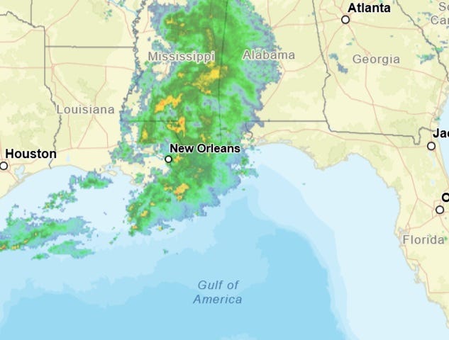
"Much of southeastern Louisiana will remain under a tornado watch until noon Sunday as thunderstorms roll through the region," WWL TV Meteorologist Alexa Trischler said.
A flash flood warning is in effect for parts of Orleans and Jefferson Parish until 10:15am.
The city of New Orleans can park on the neutral ground until 6:00pm.
There were earlier tornado warnings for parts of Terrebonne, Tangipahoa, Jefferson and Lafourche Parishes.
No confirmed tornadoes touched down and there were no reports of major damage.
Trischler says a few isolated storms could form in the afternoon, then the area dries out.
"The work week starts dry and fairly pleasant with temperatures mainly in the 70s through the afternoons on Monday and Tuesday."
A cold front arrives late Tuesday into early Wednesday.
"This will finally deliver cool and delightful fall weather starting Wednesday through the upcoming weekend. Mornings will be chilly near 40 degrees north of the lake and in the low 50s south of the lake. Afternoons will be sunny and cool in the 60s on Thursday and Friday."
Friday is Halloween.
"Friday brings temperatures in the 60s, falling into the 50s after sunset, so it will feel chilly this year for trick-or-treating and nighttime parties."