


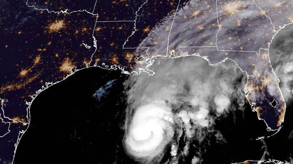

With the track shifting steadily east, the National Weather Service now expects less impact to Louisiana from Hurricane Isaias.
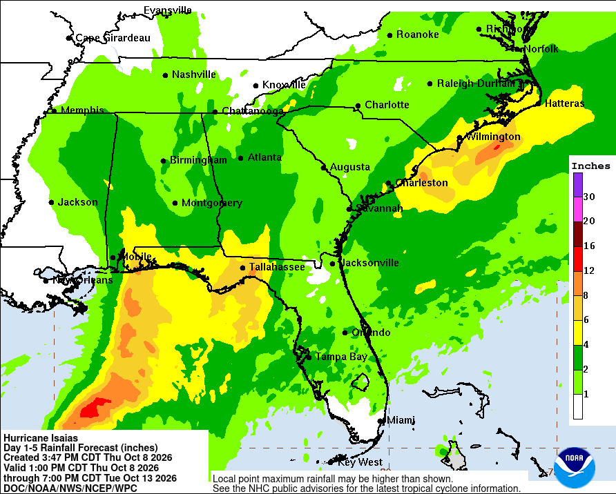
The current forecast calls for less than one inch of rain in the state.
 NOAA
NOAA
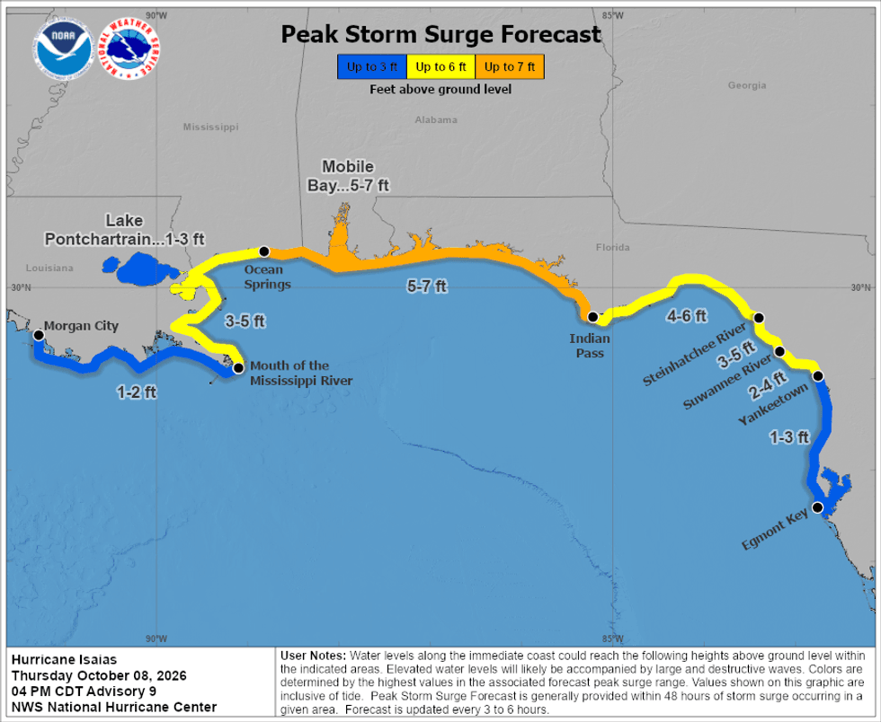
Surge projects now are just one to two feet for most of the coast and less than two feet for the lakes.
The eastern facing shores of St. Tammany, St. Bernard, and Plaquemines Parish are forecast to get up to five feet of surge.
 NWS
NWS
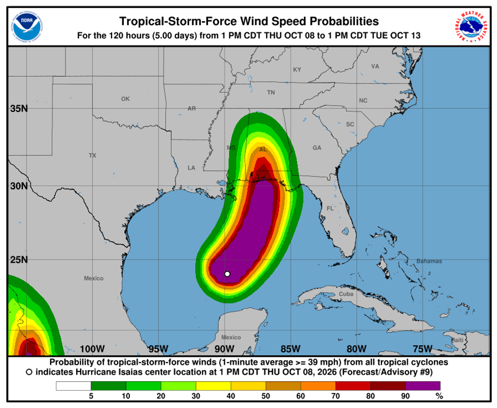
There is just a ten percent chance that Louisiana will see any tropical storm force winds.
 NWS
NWS
Landfall is expected on the Florida Panhandle.
"On the forecast track, Isaias is expected to approach the U.S. northern Gulf Coast on Friday and make landfall within the warning area late Friday or early Saturday," the Hurricane Center posted.
Maximum sustained winds could be more than 100 mph with higher gusts.
"Additional strengthening is expected through early Friday. Isaias should remain a dangerous hurricane as it approaches the northern Gulf Coast Friday night."
The impacts are expected to move through Alabama, Florida, Georgia, and into Tennessee then Kentucky on Saturday.
LSU football plays at Kentucky Saturday night.
The National Weather Service Forecast calls for rain and some wind.
"Showers and possibly a thunderstorm.... East wind 14 to 16 mph, with gusts as high as 24 mph. Chance of precipitation is 80%."