


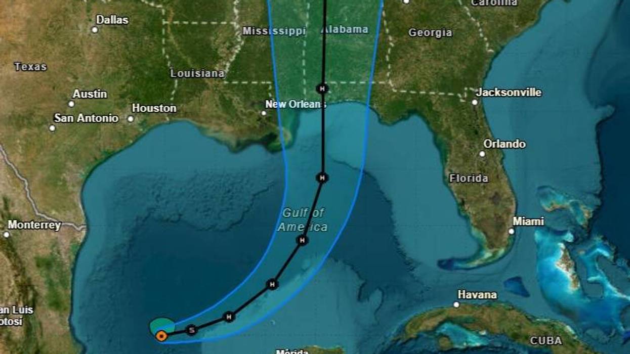

As Tropical Storm Isaias moves through the Gulf, the National Hurricane Center expects to issue Hurricane Watches for a portion of the U.S. Gulf coast later today.
New Orleans is currently not in the forecast cone.
"On the forecast track, Isaias is expected to... approach the U.S. northern Gulf Coast on Friday."
The current NHC track calls for a landfall between Mobile, Alabama and Pensacola, Florida late Friday night or early Saturday morning.
Federal forecasters say, however, that they have "below-average track confidence" at this time.
The cone of possible landfall stretches from the Louisiana / Mississippi line to near Panama City, Florida.
The current forecast calls for less than two inches of rain in Louisiana.
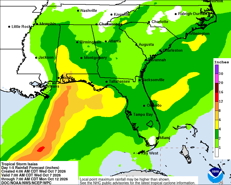 NWS
NWS
WWL TV Meteorologist Payton Malone says that while New Orleans is not in the cone, it is "too close for comfort."
He explains that the accuracy of the forecast will improve after Hurricane Hunters fly into the storm today and gather better data.
"Isaias is forecast to become a hurricane Thursday and strengthen to around 110 mph over the central Gulf by early Friday before turning north toward the northern Gulf Coast," Malone detailed.
He says areas along the Gulf Coast will start feeling effects before landfall.
"Impacts could begin Friday and continue into Saturday. The exact track is still uncertain, but the strongest rain and wind are expected near and east of the center."
Malone says with Louisiana on the edge of the cone, the impacts will be greatly dependent on just how far to the east the system moves.
"Southeast Louisiana could see heavy rain, gusty winds and coastal flooding if Isaias tracks close enough, while a farther east track would bring fewer impacts."
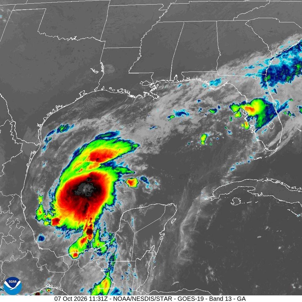 NHC
NHC