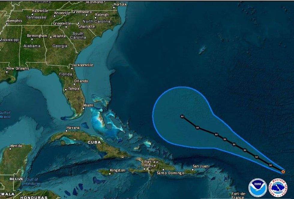
The National Hurricane Center says Hurricane Lee is already a Category 5 storm, and it is forecast to keep getting stronger.
"Maximum sustained winds based on data from the Air Force Reserve Hurricane Hunter aircraft have increased to near 165 mph... with higher gusts," the NHC advised. "Additional strengthening is forecast today."
The good news? Lee is not forecast to hit any land... at least not any time soon.
"On the forecast track, Lee is expected to pass well to the north of the northern Leeward Islands, the Virgin Islands, and Puerto Rico over the weekend and into early next week."
Federal forecasters say beyond that, it is too soon to know if the New England region of the United States or the east coast of Canada could be impacted.
 NHC
NHC
The only impact to any land for the next few days will be some higher wave action.
SURF: Swells generated by Lee are expected to reach portions of the Lesser Antilles later today, and reach the British and U.S. Virgin Islands, Puerto Rico, Hispaniola, the Turks and Caicos Islands, the Bahamas, and Bermuda this weekend. These swells are likely to cause life-threatening surf and rip current conditions. Dangerous surf and rip currents are expected to begin along most of the U.S. East Coast beginning Sunday.
WWL TV Meteorologist Payton Malone says Lee is not forecast to get anywhere near the Gulf of Mexico.
"Long-range models also keep the Gulf and adjacent waters quiet through mid-September."
He says, however, Lee could eventually impact some land.
"Long-range model guidance maintains it will remain off the coast of the U.S. through much of next week, but those along the New England Coast and Canada Maritimes should monitor the forecast closely. The entire East Coast will likely see rough seas though as the storms passes to the east."