


After an icy Tuesday morning with road and bridge closures across Southeast Louisiana, things warm up enough during the day to melt away the ice.
Then it gets even colder.
 NWS
NWS
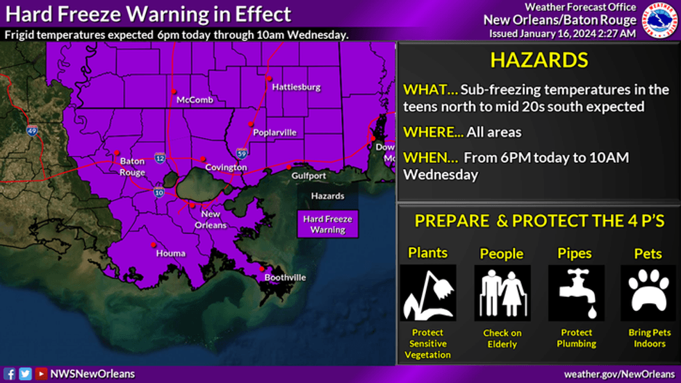
"The coldest morning will be Wednesday morning with lows reaching the lower teens to 20's and below freezing temperatures all the way to the coast," the National Weather Service office for New Orleans posted.
A hard freeze warning is in effect from 6pm tonight until 10am Wednesday morning for the region.
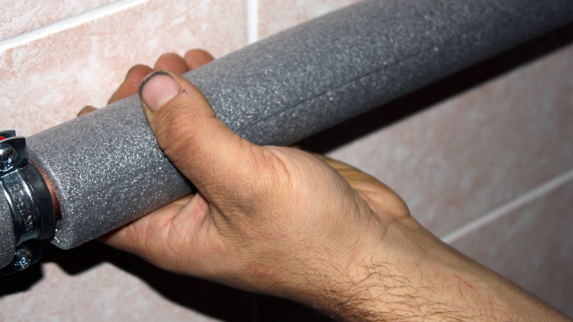
Pipes could burst on both sides of the lake.
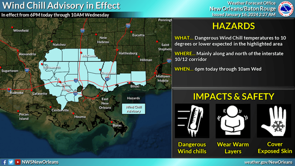
The wind will make it feel like teens and single digits.
"Wind speeds will mix with the cold air coming to bring up wind chill advisories for areas north and west of Lake Pontchartrain," the Weather Service advised.
 NWS
NWS
WWL TV Meteorologist Payton Malone says, "Protect pipes, plants, pets and people."
Here is his detailed forecast...
TODAY:
Morning moderate to hard freeze. Mostly cloudy, then clearing. Very cold and windy. Low: S 27, N 24. High: 38. Wind N 12-20 mph.
WEDNESDAY:
Morning hard freeze north and south of the lake. Mostly sunny and cold. Low: S 26, N 16. High: 45. Wind E/SE 5-10 mph.
THURSDAY:
Morning freeze north of the lake, light freeze or frost possible south of the lake. Mostly sunny and warmer. 20% chance of showers. Low: S 39, N 30. High: 68.
FRIDAY:
Mostly cloudy and breezy. Low: S 44, N 39. High: 50.
SATURDAY:
Morning hard freeze north, light freeze south. Sunny and chilly. Low: S 30, N 24. High: 43.
SUNDAY:
Morning hard freeze north, light freeze south. Partly cloudy and chilly. Low: S 32, N 26. High: 49.
MONDAY:
Mostly cloudy and warmer. Low: S 44, N 34. High: 60.


