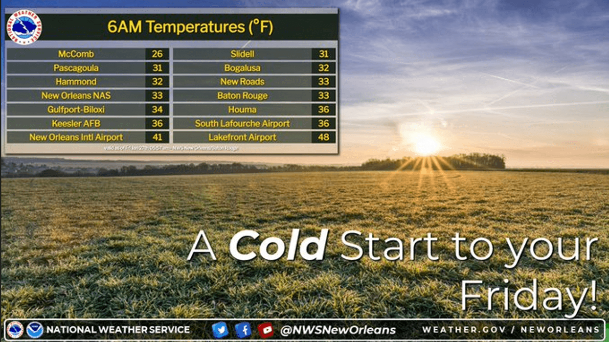
Temps dipped into the 30s on both sides of the lake this morning.
"The afternoon will be nice in the upper 50s," WWL TV Meteorologist Payton Malone forecasts. "Tonight will be chilly in the 30s and 40s, but no freeze is expected."
He says we warm up tomorrow ahead of a storm system Sunday.
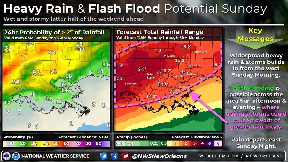
"Saturday will be dry in the upper 60s. Sunday, on the other hand, looks a bit wet. 60-70% rain throughout the day with a threat for some isolated to scattered flooding."
Malone says heavy downpours are possible with some areas getting three or more inches of rain.
 NWS
NWS
"There will be breaks in the rain Sunday, so parts of the day will be dry, but the late afternoon evening will likely be fairly wet. "
Detailed Forecast...
TODAY:
Cold morning, chilly afternoon. Mostly sunny. More late clouds. High: 59. Winds: Var 5-10.
SATURDAY:
Some patchy AM frost. Chilly morning, milder afternoon. Partly cloudy. Breezy. Low: S 42, N 35. High: 68.
SUNDAY:
70% numerous showers and some storms. Isolated flooding possible. Milder temps, breezy. Low: S 58, N 53. High: 70.
MONDAY:
Partly sunny, mild. Isolated shower. Low: S 59, N 55. High: 70.
TUESDAY:
Mostly cloudy. 30% scattered showers, warmer. Low: S 60, N 55. High: 70.
WEDNESDAY:
Mostly cloudy. 30% scattered showers. Warm, more humid. Low: S 62, N 58. High: 71.
THURSDAY:
50% scattered showers and storms. Warm early, then falling afternoon temps. Breezy. Low: S 63, N 61. High: 65. Late night: low 50s.