There will be no gray area this weekend in Mandeville: If you are out at the lakefront after curfew and don't live in the area, you will be arrested.
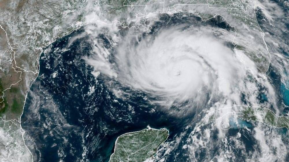
That's what Mayor Clay Madden said Saturday during a press briefing ahead of Hurricane Ida, which is projected to strengthen to a Category 4 storm before making landfall in Louisiana overnight into Monday.
"If you are at the Mandeville lakefront after midnight [Saturday] and you do not live in the vicinity, you will be experiencing Hurricane Ida from the clink," Madden said. "We are not tolerating hurricane tourism in Mandeville anymore."
Madden announced the curfew that goes into effect at midnight Saturday evening, along with a voluntary evacuation for areas south of Monroe Street in Old Mandeville. While the area isn't expected to bear the brunt of the storm as it hits the state, Mandeville could experience winds in excess as 74 mph and up to 110 mph, the mayor said.
He also reminded residents that should Mandeville experience sustained winds above 39 mph, emergency services such as ambulance, police and firefighters will cease until safer conditions return. Madden, who noted that Aug. 28 marked his 1-year anniversary in office, encouraged residents to take pictures of their home ahead of the storm for record purposes if they have to make an insurance claim.
Madden gave out his personal cell number in his comments, which can be heard in the player above, and also noted that any reports of damage or emergency requests should be sent to HurricaneIda@cityofmandeville.com, a dedicated email account set up for that purpose.
Ida had entered the Gulf as of Saturday as a Category 1 storm, but was expected to strengthen rapidly as it moved through the warm waters approaching the coast. The storm was expected to reach Category 3, and could strengthen as high as Category 4 with winds in excess of 130 mph before landfall.
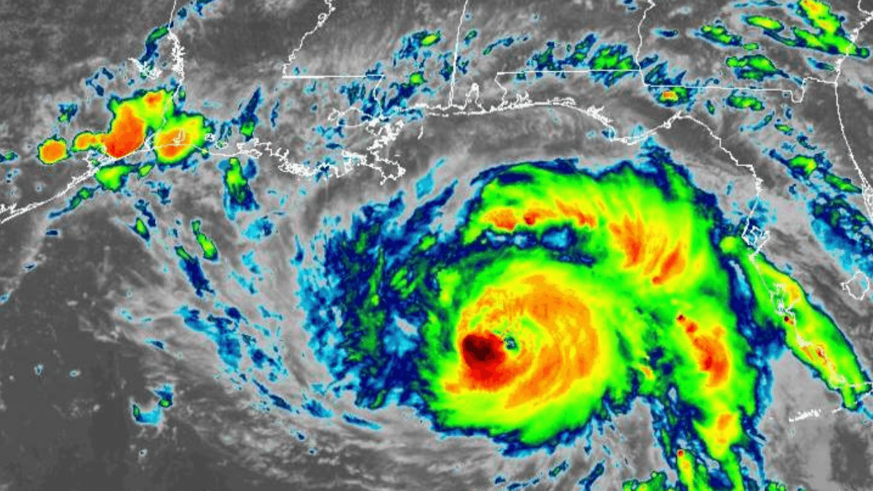
The storm's track has remained remarkably consistent over the past several days, and appears assured to landfall in Louisiana west of New Orleans and likely in the area of Terrebonne Parish. Wherever the storm comes on land, the result will be difficult to watch, said NWS meteorologist Ben Shot in an interview Saturday, while encouraging residents to leave if they can.
“It’s going to be horrible. Your home is never going to look the same. Your neighborhood is never going to look the same. And that’s not hype. This is a strong Cat 4 storm," Shot said. "It’s going to take an amazingly reinforced construction to survive Cat 4 winds along the coast, and if you have a chance to get out between now and when it starts to really impact us late tonight, I recommend you do. Don’t take the chance.”