The low pressure system from Fred reorganized into a tropical cyclone today, with top winds of 40 mile per hour, strong enough for the National Hurricane Center to once again designate it Tropical Storm Fred.
The center re-formed north of what the hurricane center had previously advised, which resulted in the track shifting to a potential landfall further east of our area.
"While the forecast guidance is basically unchanged in calling for a north-northwest motion followed by a turn toward the north near landfall on the northern Gulf coast, the new initial position requires the forecast track to be shifted about 40 n mi to the east of the previous track through the landfall time," explained Senior Hurricane Specialist Jack Beven.
"Fred is now expected to make landfall in the western Florida Panhandle sometime Monday afternoon or evening," said Beven.
A tropical storm watch has been issued from the Alabama/Florida line on the Gulf coast through Navarre, Florida. A tropical storm warning is in effect from Navarre east through Wakulla/Jefferson County line.
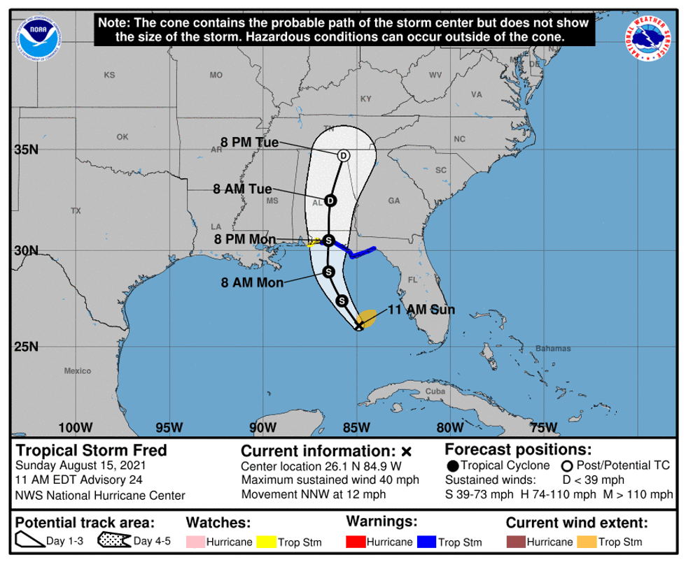
Some intensification is expected before landfall, but forecasters do not expect Fred to become a hurricane.