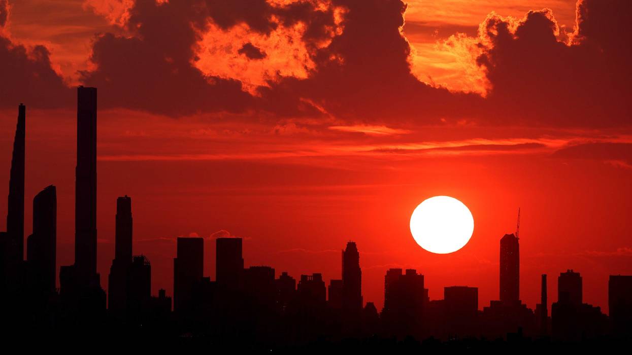
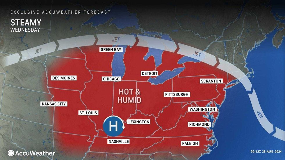
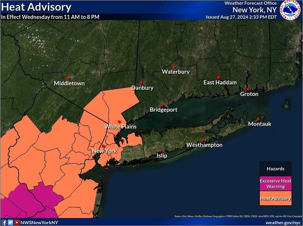
NEW YORK (1010 WINS) – A heat advisory was issued for much of the New York City area on Wednesday as 90-degree temps return, along with the threat of damaging thunderstorms.
The heat advisory is in effect until 8 p.m. for all five boroughs of NYC, as well as a swath of Westchester, North Jersey, Nassau County and the Hudson Valley.
Conditions have been relatively cool the past week, but highs are set to surge to 94 in Midtown Manhattan, according to AccuWeather. With the humidity, it will feel more like 100 degrees.
 AccuWeather
 National Weather Service
NYC Emergency Management said cooling centers are open Wednesday. Find ways to stay cool at NYC.gov.
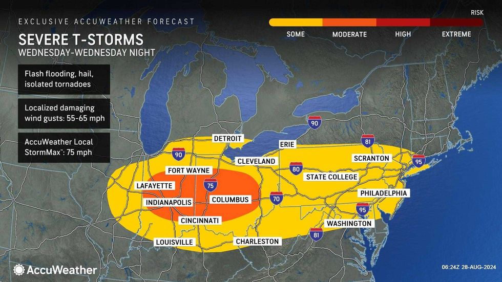
On top of the heat, there's a chance of heavy thunderstorms in the afternoon, evening and night as a cold front approaches from Canada. The storms may pack damaging wind gusts and hail.
 AccuWeather
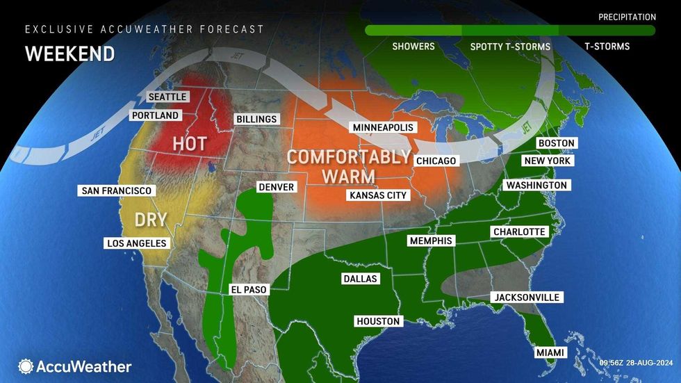
After the storms move out, it's set to be much cooler and less humid going into the weekend.
Highs are only expected to be 76 on Thursday and 74 on Friday. It'll otherwise be dry and partly cloudy both days.
 AccuWeather
 AccuWeather
Looking ahead, Labor Day weekend will start stormy but end very nice.
Thunderstorms and showers may pop up on Saturday and Sunday as temps stick to the upper 70s and low 80s.
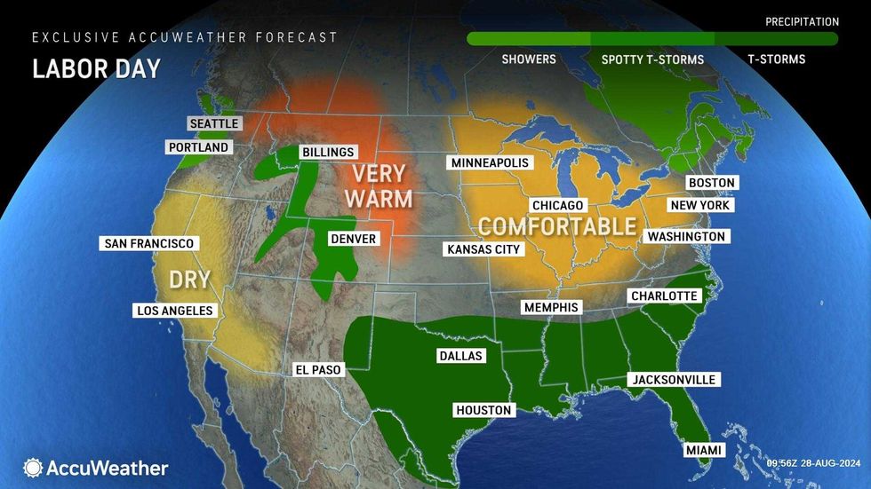
Labor Day will be very nice, with less humidity, sunny skies, and highs in the 70s.