Good muggy morning and welcome to Wednesday. Storm chances ramp up Friday through the weekend, some may become severe.
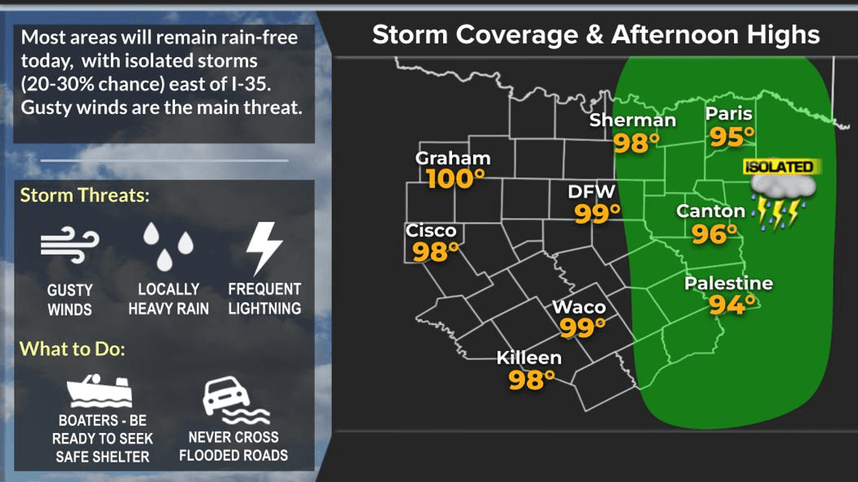
Low clouds have invaded the area this morning and temperatures are very mild. Readings are in the mid to Upper 60s. There's nothing showing up on the radar, however, there'll be a few showers up along the Red River Valley through late morning and an isolated shower to possible anywhere across North Texas through early afternoon. Afternoon highs today will top out near 80°.
Morning clouds, peeks of afternoon sunshine for your Thursday. It'll be windy and warm again with highs near 80°. Any storms that form off to the west of it should stay out there through the late evening.
 National Weather Service - Fort Worth
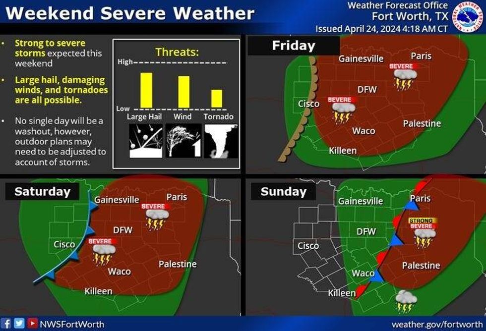
By Friday morning, an area of strong storms will be moving into the area during your morning commute, ending from west to east by noon. The severity will be low. Peeks of sunshine by afternoon with highs again near 80°.
Our next storm chance arrives late Saturday. Some of these will become severe by late afternoon and evening. High temperatures will warm into the mid-80s. Storms will stick around through the overnight hours as another round comes through the first half of Sunday. Some of these storms may become severe. We should be rain-free by Sunday afternoon with highs in the mid-80s again.
As of now, Monday and Tuesday look dry with highs in the mid 80s.
*Yest Rain: 0.00"; Yest High: 77; Low: 57
*Today's Averages: High: 78; Low: 57
*Record high: 91 (1950, 1984, 2020); Record low: 37 (2019)
*April Rain: 3.81"; Surplus: 1.46"
*2024 Rain: 14.61"; Surplus: 3.67"
*Sunrise: 6:47am; Sunset: 8:05pm
LISTEN on the Audacy App
Tell your Smart Speaker to "PLAY 1080 KRLD"
Sign Up to receive our KRLD Insider Newsletter for more news
Follow us on Facebook | Twitter | Instagram | YouTube