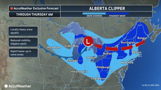

Buffalo, N.Y. (WBEN) - The countdown to New Year's Eve and ringing in 2026 includes a round of lake enhanced snow for the Buffalo metro area that will impact revelers gathering for festivities in downtown Buffalo.
A Winter Storm Warning has been expanded to include the metro Buffalo area through early New Year's Day for northern Erie and Genesee counties, and continuing through Friday night for southern Erie County and the southern tier. A Winter Weather Advisory is posted through early New Year's Day for Niagara and Orleans counties.
While the snow is significant and accumulating, it is not to the degree that it will prohibit New Year's revelers from turning out for festivities.
"Anyone that is coming downtown tonight, it’s going to be a steady snow, but at a manageable rate," meteorologist Andy Parker tells WBEN. By time the ball drops and spectators head home, the snow should have shifted well to the south.
The southward shift will occur between 9 p.m. and 11 p.m., Parker predicts.
Expect 6-12 inches of accumulation, with the greatest amounts from the Buffalo southtowns to western Genesee County. Snowfall rates may reach 2 inches per hour at times this afternoon through this evening.
Dress warmly, however, with temperatures in the teens and wind chills in the single digits by midnight. Temperatures for Friday and Saturday will be in the upper teens to mid 20s for most areas. Overnight lows for Thursday through Saturday nights will be in the single digits to mid teens for most areas.

WINTER STORM WARNING IN EFFECT FROM 1 PM THIS AFTERNOON TO 1 AM EST THURSDAY
* WHAT...Heavy snow expected. Total snow accumulations 6 to 12 inches.
* WHERE...Northern Erie County. The greatest accumulations will be across the Buffalo Southtowns.
* WHEN...From 1 PM this afternoon to 1 AM EST Thursday.
* IMPACTS...Travel will be very difficult with snow covered roads and poor visibility. The hazardous conditions will impact the Wednesday morning and evening commutes.
PRECAUTIONARY/PREPAREDNESS ACTIONS...
Widespread accumulating snow will create dangerous travel conditions.
Submit snow reports through our website or social media.
During lake effect snow, the weather can vary from bands of locally heavy snow with greatly reduced visibilities to dry conditions just a few miles away. Be prepared for rapid changes in weather, visibility, and road conditions.
WINTER WEATHER ADVISORY REMAINS IN EFFECT UNTIL 1 AM EST THURSDAY
* WHAT...Lake effect snow. Additional snow accumulations 3 to 6 inches in the most persistent lake snows. Winds gusting as high as 35 mph.
* WHERE...Niagara, Orleans, and Monroe Counties.
* WHEN...Until 1 AM EST Thursday.
* IMPACTS...Travel will be difficult at times with poor visibility and snow covered roads.
PRECAUTIONARY/PREPAREDNESS ACTIONS...
During lake effect snow, the weather can vary from bands of locally heavy snow with greatly reduced visibilities to dry conditions just a few miles away. Be prepared for rapid changes in weather, visibility, and road conditions.
WINTER STORM WARNING NOW IN EFFECT UNTIL 10 PM EST FRIDAY
* WHAT...Heavy snow. Additional snow accumulations 1 to 2 feet.
* WHERE...Wyoming, Chautauqua, Cattaraugus, and Southern Erie Counties. The greatest accumulations will be across the Chautauqua Ridge, Boston Hills, and western Wyoming County.
* WHEN...Until 10 PM EST Friday.
* IMPACTS...Travel will be very difficult with snow covered roads and very poor visibility. The hazardous conditions will impact the Wednesday evening commute.
PRECAUTIONARY/PREPAREDNESS ACTIONS...
During lake effect snow, the weather can vary from bands of locally heavy snow with greatly reduced visibilities to dry conditions just a few miles away. Be prepared for rapid changes in weather, visibility, and road conditions..
Related
