
Buffalo, N.Y. (WBEN) - After a calm and dry Christmas Day, a messy Friday is in store for all of Western New York.
A Winter Weather Advisory is posted for ALL of WNY from Friday morning through early Saturday.
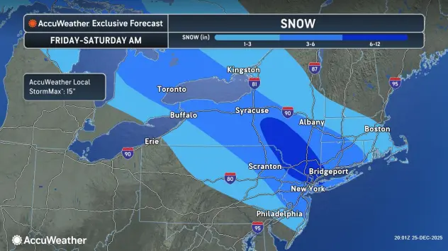
A mixed bag of snow, sleet, and freezing rain is expected across WNY, with the greatest amounts of ice accumulation across the western Southern Tier.
Expect very little snow for the western southern tier, where ice and sleet dominate, National Weather Service forecasters say.
Across the Buffalo-Niagara region, snow amounts are highly uncertain given precipitation type uncertainties. Forecasters expect accumulations to be in the 1 to 4 inch range, with sleet holding down snow amounts. If precipitation stays mainly snow, accumulations will be higher (likely the 3-6" range).
For ice accumulations, expect 0.10" to 0.25" across the western southern tier, but portions of Chautauqua County may reach the 0.25" to 0.50" range if freezing rain is predominant. There is a small potential Chautauqua County may exceed 0.50" and reach Ice Storm Warning criteria, but not enough confidence in that scenario yet
The snow and mixed precipitation will quickly taper off from west to east Friday night, with most of the precipitation done by late evening across WNY.
Bills-Eagles Sunday
No stadium dig-out will be necessary when the Buffalo Bills host the Philadelphia Eagles at Highmark Stadium in Orchard Park Sunday, with milder temperatures forecast to prevail.
"We're expecting highs in the low 40's," Pandolfo says. "That will be accompanied with widespread rain across much of the area on Sunday."