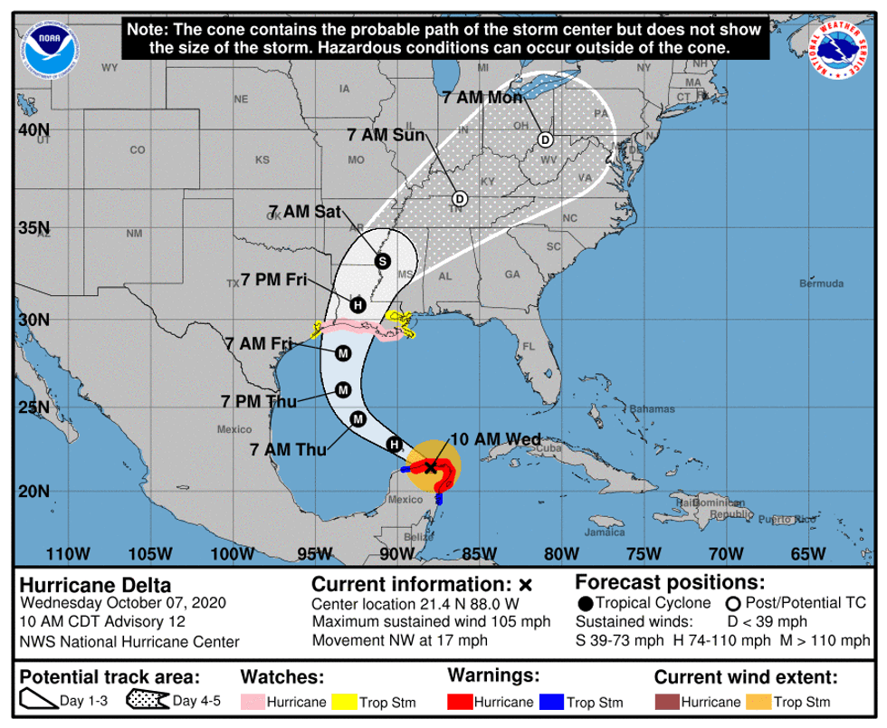
The National Hurricane Center has taken New Orleans and Southeast Louisiana out of the landfall cone of error for Hurricane Delta.
Federal forecasters, however, say the city and region could still feel tropical storm force winds as Delta heads for a landfall near Lake Charles Louisiana. The cone now includes portions of Texas.

A Hurricane Watch now extends from west of Grand Isle to High Island Texas.
"On the forecast track, the center of Delta will move over the southern Gulf of Mexico this afternoon, be over the southern or central Gulf of Mexico through Thursday, and approach the northern Gulf coast within the hurricane watch area on Friday."
Southeast Louisiana, meanwhile, is under a Tropical Storm Watch.
"Delta is expected to grow in size as it approaches the northern Gulf Coast, where there is an increasing likelihood of life-threatening storm surge and dangerous hurricane-force winds beginning Friday, particularly for portions of the Louisiana coast."
Delta's winds are down to 105 miles per hour, but the Hurricane Center expects it to intensify again.
"Re-strengthening is forecast when the hurricane moves over the southern and central Gulf of Mexico through Thursday, and Delta is expected to become a major hurricane again. Some weakening is forecast as Delta approaches the northern Gulf coast on Friday."
Forecasters expect winds to top out at 120 miles per hour.
Hurricane Laura hit with 150 mph winds in the same area where Delta is forecast to make landfall.