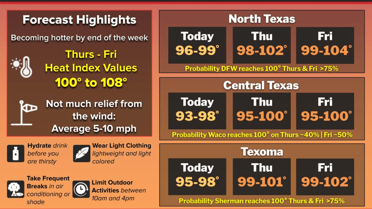
Here we go, starting today, or entering our hottest time of the year here across North Texas. This period is characterized by average high temperatures reaching 97°, persisting for approximately three weeks.
Yesterday, we only reached 96°. Today, we will again reach the upper 90s, but no heat advisories have been issued yet, as they remain to the east of the Dallas-Fort Worth area for the time being. This will change as we head into Thursday and Friday.
Widespread heat advisories and excessive heat warnings stretch up the Mississippi River Valley all the way into the Midwest and Great Lake States today. This is where the upper-level ridge of high pressure is centered. As we work our way through the next 48 hours, this ridge will build further into North Texas, allowing us to approach 100° tomorrow and on Friday. I anticipate that heat advisories will be issued for DFW during that time span. These are issued when the heat index reaches 105° for two consecutive days.
Parts of Texas will get some relief Friday and Saturday as an easterly wave moves into the Gulf Coast. A few of these showers could sneak into our southeastern counties Friday and Saturday by late afternoon and evening, but most of us will stay dry. Afternoon highs this weekend will reach the mid to upper 90s, a little cooler, but with more humidity in the air during the afternoon hours.
We're back to sunny and hot conditions to start off next week. Morning lows will be near 80°, afternoon highs will reach the upper 90s, with heat index values near 104°. This is just below heat advisory criteria.
That's all I've got on this fine Wednesday morning! Have a blessed day, pray for Texas, and enjoy the weather when you can, it's the only weather you've got!
7-Day Headlines:
* DFW Airport reached 96 on Tuesday.
* Heating up through the rest of the week.
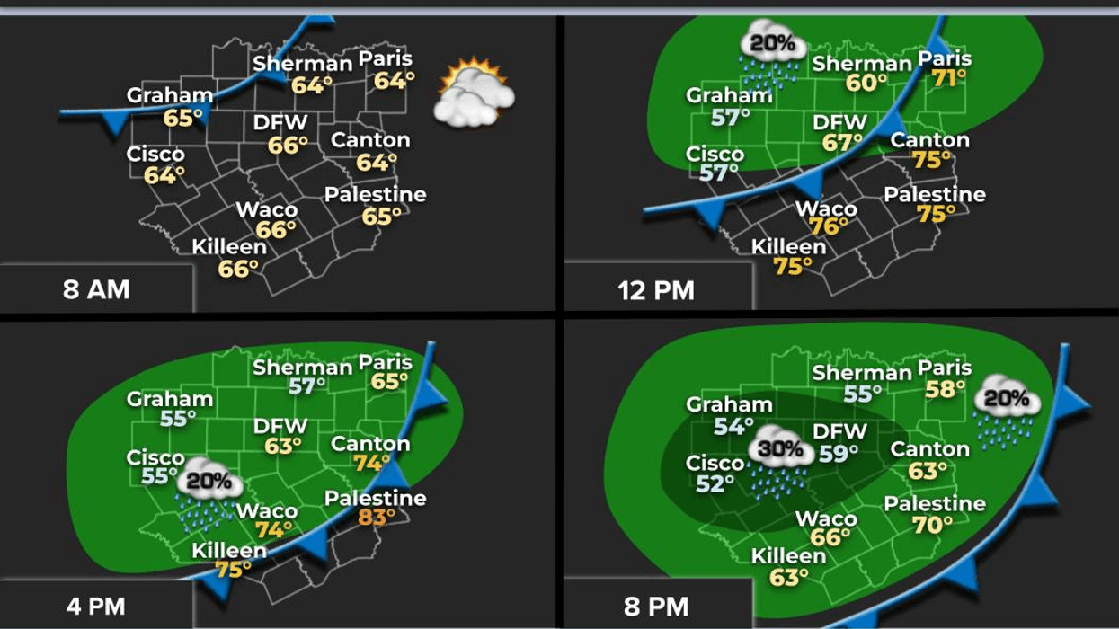
* Heat Advisories east of us today.
* Heat advisories possible Thursday and Friday.
* A few showers and storms SE of DFW Friday and Saturday.
* Hot and dry next week.
*Yest Rain: 0.00"; Yest High: 96; Low: 77
*Today's Averages: High: 97; Low: 76
*Record high: 105 (1974); Record low: 59 (1970)
*July Rain: 1.09"; Deficit:
*2025 Rain: 21.73"; Surplus: 0.21"
*Sunrise: 6:37am; Sunset: 8:32m
Wednesday: Sunny and hot. High: Upper 90s. Heat index: Near 104 degrees. Wind: South 10-20 mph.
Wednesday night: Clear and muggy. Low: Mid to upper 70s. Wind: South 10-20 mph.
Thursday and Friday: Mostly sunny and hot. Possible Heat Advisories. A few showers SE of DFW on Friday. High: Near 100. Heat index: Near 100. Wind: South 5-15 mph.
Weekend: Sunny, hot and humid. An isolated storm SE on Saturday. High: Mid to upper 90s. Heat index near 103 degrees.
Monday and Tuesday: Sunny and continued hot. Highs: Upper 90s. Heat index: Near 104 degrees
LISTEN on the Audacy App
Tell your Smart Speaker to "PLAY 1080 KRLD"
Sign Up to receive our KRLD Insider Newsletter for more news
Follow us on Facebook | Twitter | Instagram | YouTube